
PRF

Phytoliths

Laboratory of Archaeobotany and Palaeoecology

Phytolith analysis

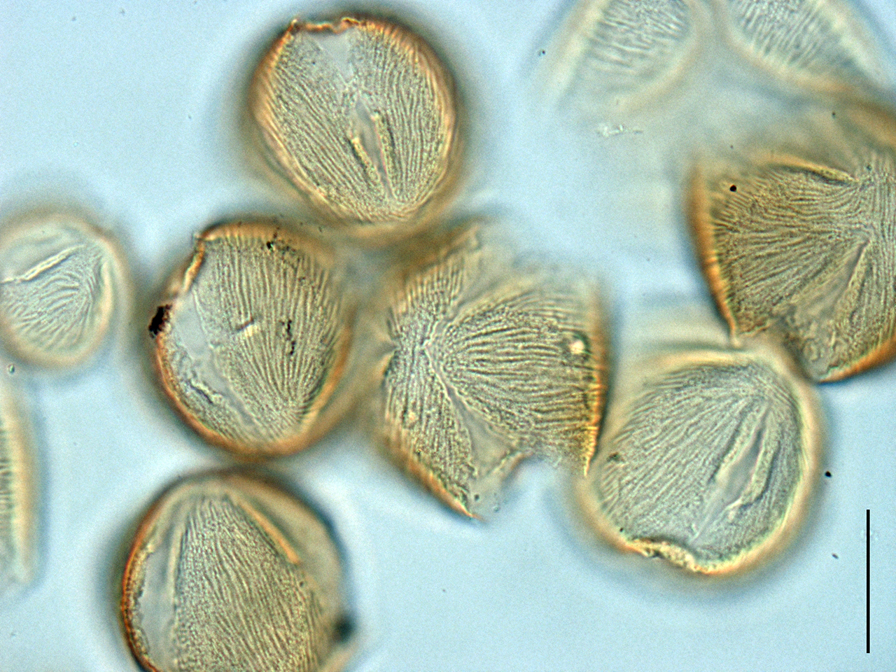
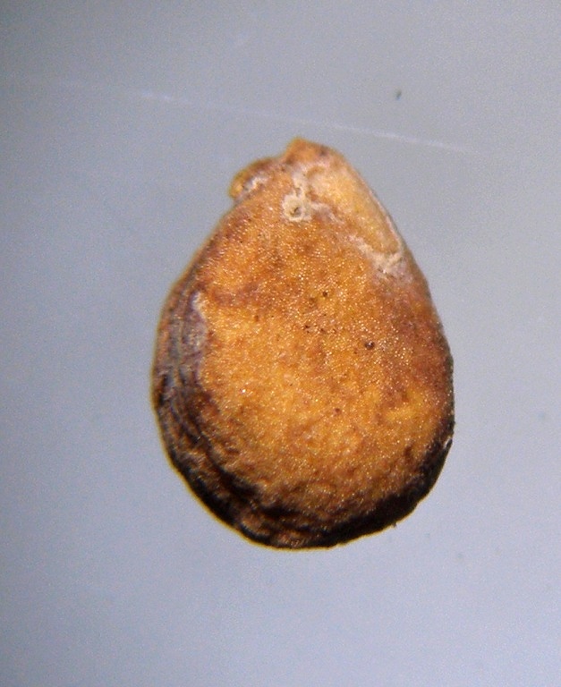
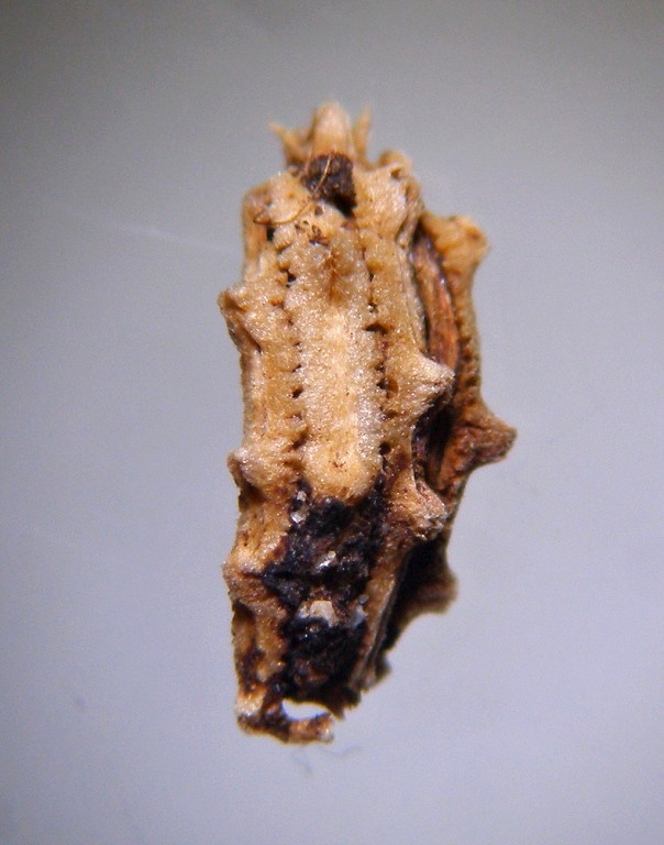
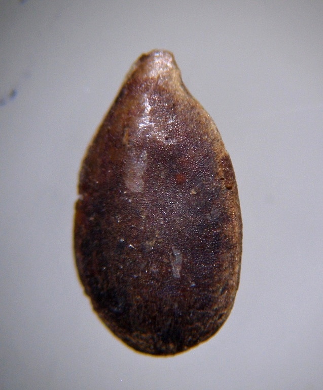
Phytoliths are microscopic particles that form in leaves, stems, roots, flowers or fruits of plants. Most often, these are incrustations formed outside or inside the cells by the accumulation of silica (so-called silicate phytoliths), calcium oxalate, or carbonates. Specific types of cells or their parts or entire sets of cells (for example epidermis) can be encrusted, either their interiors, cell walls or both at the same time. Different taxonomic groups of plants differ in the method of deposition and shape of phytoliths. In many families, specific types of phytoliths were found allowing their determination. Identification at a lower level (genus) is also becoming more frequent, a number of taxa can even be identified down to the species level based on characteristic phytoliths.

After decomposition or burning of plant material, phytoliths (mainly silicate) remain in practically unchanged form and persist for a long time in soil, sediments and other media as a record of the existence of their parent plants.

Possibilities of using phytolith analysis

The potential of phytolith analysis Greater experience with the phytolith taxonomy of present-day plants enables researchers to detect some plant taxa in archaeological sediments based on silica microfossils. The most studied phytolith assemblages come from Central and South America (Piperno 1998a, 1998b; Piperno et Becker 1996; Piperno et al 2000; Piperno et al 2001), North America (McClaran 2000, Fearn 1998, Fredlund et Tieszen 1997, Bozarth 1992, Brown 1984), tropical Africa (Mercader et al 2000, Runge 1999, Barboni et al 1999), New Zealand (Carter 2000, Horrocks et al 2000), the Near East (Rosen 1992), and South-East Asia (Kealhofer et al 1999, Kealhofer et Penny 1998, Zhao et al 1998). Phytoliths are invaluable in archaeology for the detection of cereals (the grass family is an abundant phytolith producer) and other subsistence plants, eg. maize and squash in America (Pearsall 1978, Piperno 1984, Piperno et al 2000, Piperno et Flannery 2001), rice in Asia (Jiang 1995, Whang et al 1998, Zhao et al 1998, Huang et Zhang 2000), and cereals of the Old World (Rosen 1992, Ball et al 1999, Ball et al 1996, Kaplan et al 1992). Though phytolith analysis has an enormous potential, identification using phytoliths is complex and difficult to apply at refined levels of taxonomy.

Phytoliths (like pollen) are used as guide fossils reflecting changes in conditions over time; they indicate ancient dietary and cultural practices; they serve as forensic tools of criminology and can indicate different types of depositional environments (e.g. marine versus terrestrial sediments). Unlike pollen, they are not only preserved in an anaerobic acid environment (typically in bogs), but also in most less extreme conditions, which is widely used. In general, phytolith analysis has much in common with palynology. In the last three decades, phytolith analysis has been the domain of Anglophone countries: primarily the USA, then New Zealand and Great Britain.

Taxonomy of Phytoliths

The occurrence of silicate phytoliths in different taxonomic groups was summarized by Piperno (1988). The best known and most important families with consistent accumulation of phytoliths so far demonstrated are Poaceae and Cyperaceae. The occurrence of calcium oxalate phytoliths is reported in many groups (Arnott 1976, Franceschi et Horner 1980), and their distribution and morphology are traditionally studied in systematic botany. They are consistently produced by, for example, Cactaceae, the morphological diversity of their oxalate phytoliths allows determination into genera and, in the case of prickly pears, into species (Jones et Bryant 1992). Phytoliths formed by calcium carbonate are formed, for example, in the families Urticaceae, Moraceae, Acanthaceae, Cannabinaceae.

Calcareous phytoliths have been studied in less detail than silicate phytoliths from a palaeoecological and archaeobotanical point of view, although they are formed quite often in plants. This is because the frequency of their findings in paleo sediments is usually very low due to unfavorable conditions for preservation and unsuitable conditions for carbonates during the separation of phytoliths from samples (many separation techniques include rinsing in an acidic environment). In general, the systematics of phytoliths is highly heterogeneous and there are several approaches to their classification, which individual authors or working groups create to suit the intended application of the data. A description of the long-term used and updated classification system is given, for example, by Pearsall et Dinan (1992), Piperno (1988), a special classification of dicotyledonous phytoliths is given by Bozarth (1992), Poaceae see Mulholland et Rapp (1992, 1989), Twiss (1992), Twiss et al. (1969).
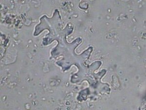
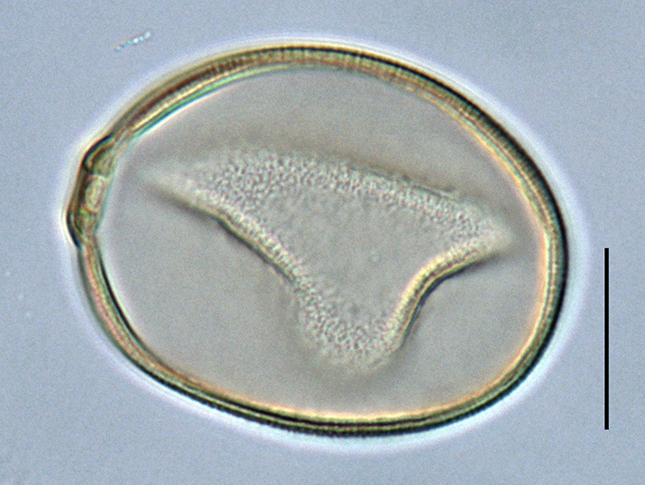
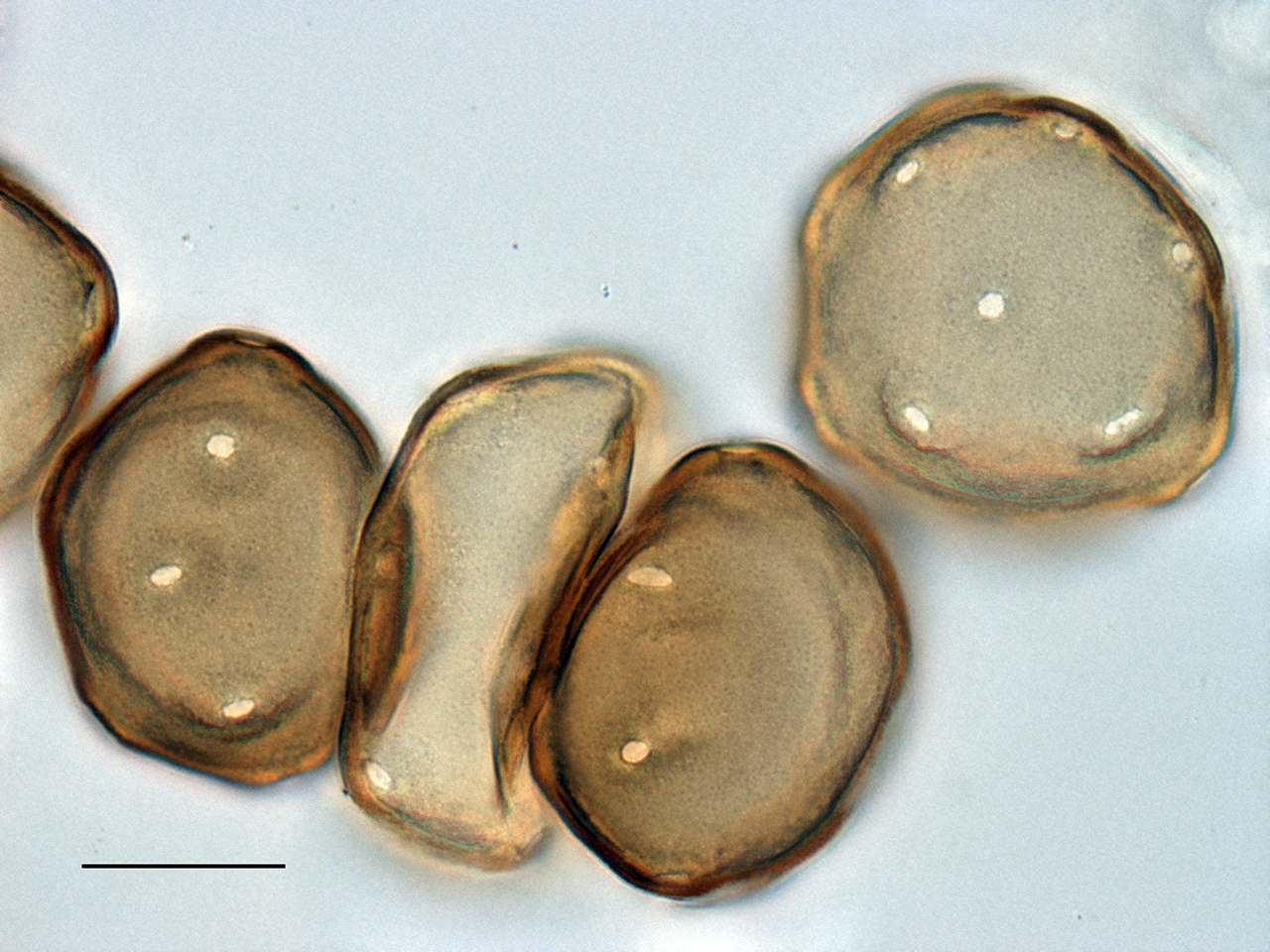
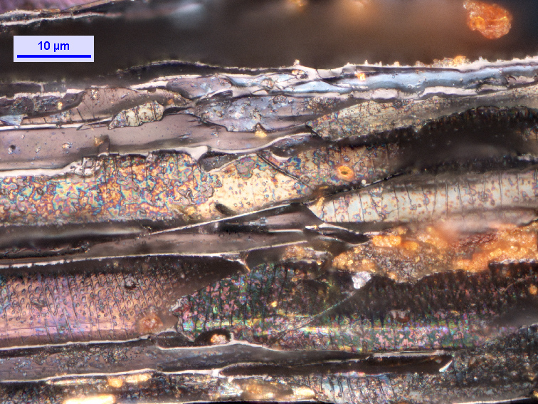
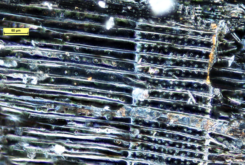
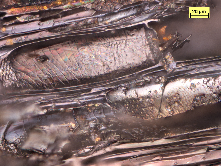
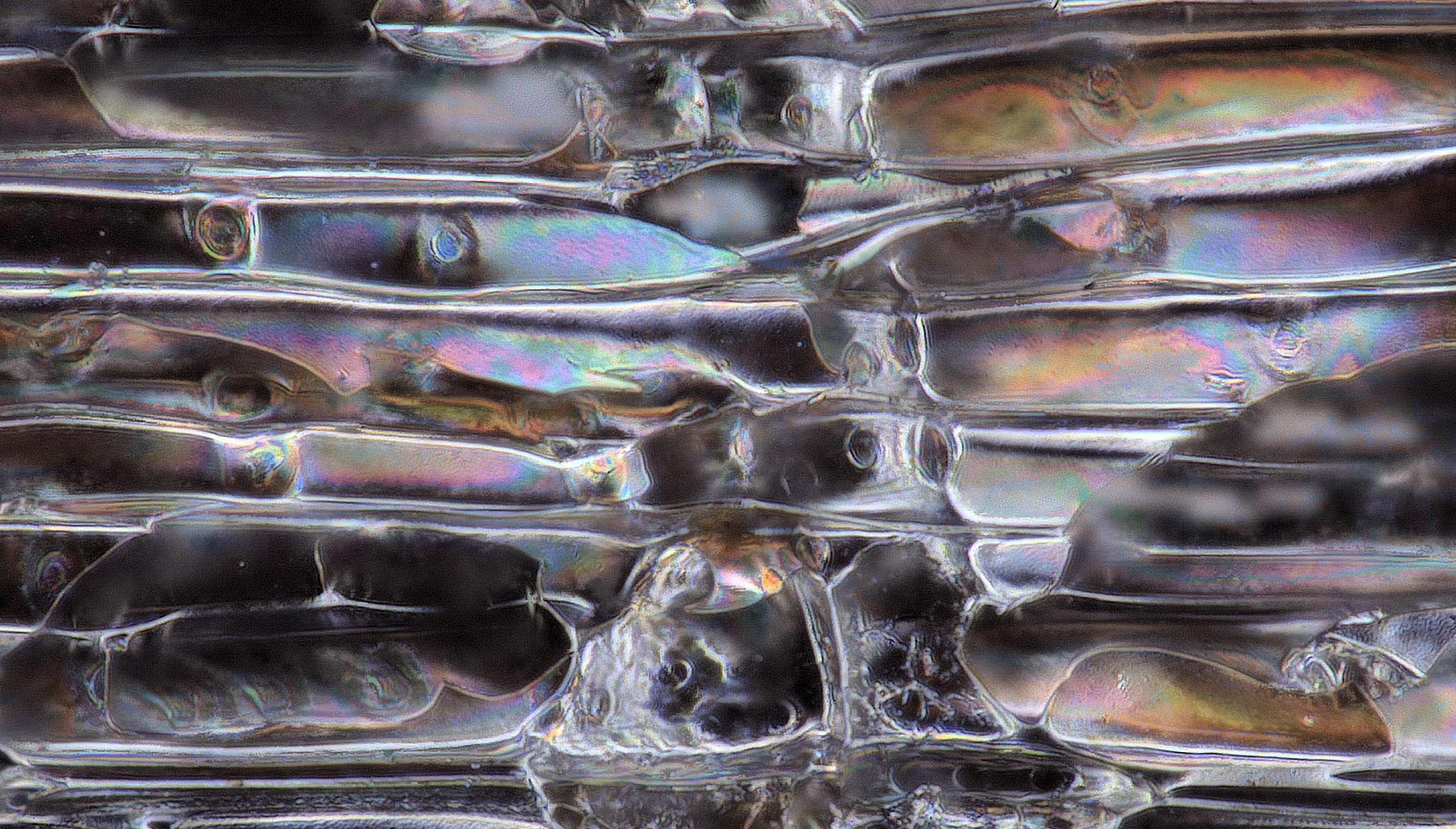
Phytolith, Poaceae.

Phytolith analysis at LAPE

Due to the fact that in the Czech Republic there is still no workplace dealing with the study of phytoliths in more detail, the LAPE collective is interested in the application of this method in our conditions. Specifically, we are counting on the initial use of the method as part of complex archaeological and archaeobotanical research currently being carried out on Czech archaeological sites from the agricultural prehistory and the Middle Ages. The expected benefit of phytolith analysis lies mainly in the possibility of detecting the practices of the time when handling plant material and reconstructing the type of vegetation cover in the vicinity of the studied settlements. A frequent type of object investigated here is, for example, a granary, i.e. the destroyed remains of a silo, the filling of which contains deposits from the current or immediately following period of the existence of the settlement. We assume that in such objects we will find a statistically significant amount of phytoliths, which would broadly show the composition of the plant material that was handled on the settlement. In addition to the study of sunken objects, we will use cultural layers - the so-called life horizons - which are large-scale deposits created in the residential areas of agricultural settlements of prehistoric times and the early Middle Ages. The samples collected by the network method in the vicinity of the Neolithic longhouses will help in solving the questions of microdistribution of various manipulations with plant material. Another variant will be sampling directly from Neolithic (or younger) grain mills, where phytoliths of cultivated cereals are preserved in high concentrations and in a determinable state.

Back to the Research

Read more …Phytoliths

  • Hits: 8278

Palynology

Laboratory of Archaeobotany and Palaeoecology

Palynology - pollen analysis

Palynology (pollen analysis) is a branch of archaeobotany that applies botanical and paleobotanical techniques to archaeological research. It deals with the analysis and historical interpretation of pollen grains found in the sediments of archaeological sites and other anthropogenic formations (e.g. wells, waste pits, fields).

obl2_petka

Field work. Photo: J. Novák

Archaeological palynology reveals the character of ancient landscapes, agricultural practises, and human settlements. It is one of the key tools unveiling the history of common life. In contrast to classical methods used in archaeology, the description of the human impact on the landscape, derived from the pollen record, is more detailed and complex. A disadvantage of this method is the requirement for a special type of sediment: only the permanent contact of the sediment layer with a wet environment ensures the good preservation of pollen grains.

Most results from the Czech Republic have been gathered from medieval features in larger Czech towns. The reason is the high frequency of archaeological rescue excavations in these towns and the sufficiency of sediments suitable for pollen preservation and recovery. The most suitable features are medieval wells, cesspits of various origin and use, and also diverse deposits, mostly with organic material.

pyl2

Pollen grains of oats (Avena sativa). Photo: P. Marešová

What has been found so far?

Pollens are usually present in high quantity and rich in species. The information derived from the pollen spectrum concerns both the close vicinity of the deposit (e.g. composition of vegetation next to the well or sump) and the composition of arable crops and plants used in the kitchen or husbandry. Ruderal plants and plants adapted to trampling are frequently detected. The occurence of certain species can indicate soil eutrophication.

The vegetation cover of a larger area (natural or semi-natural stands surrounding the settlement) can only be reconstructed on rare ocasions. The further back in the past the more difficult it is to detect some signs of presence of man and his impact on the landscape in pollen spectra. Neolithic settlement and landscape disturbance can only be documented by cereal pollen in cases where sediment suitable for pollen analysis is available next to the settlement.

petka

Field work. Photo: L. Bílý

What should be noted?

Pollen grains of cereals and other types of synanthropic plants usually prove Neolithic settlement and disturbance of the surrounding original environment only when suitable sediment for palynoanalytical research is found in the immediate vicinity of the settlement. Proving the presence and activity of Mesolithic man using pollen analysis is already a problem. It is generally believed that the Mesolithic group had about as much influence on the vegetation cover as game herds, which means that there is a lack of plant-based, clearly anthropogenic indicators that would prove Mesolithic activity at individual sites.

The disadvantage of pollen analysis is that not every type of sediment is suitable for it. An important moment of successful palynoanalytical research for the needs of archaeologists is finding suitable material - preferably sediment that has been in contact with a moist environment.

pyl1

Pollen grains of walnut (Juglans regia). Photo: P. Marešová

Pollen analysis can usually help in the following ways:

  • The reconstruction of both the natural and man-affected environment over a certain time period and geographic area.
  • The reconstruction of changes in vegetation cover induced by humans.
  • The reconstruction of agricultural practises, pasture, gathering of plants, ploughing, establishing and deserting settlements, forest clearing and burning, selective logging etc.

pyl3

Cherry (Cerasus avium) pollen grains. Photo: P. Marešová

Back to the Research

Read more …Palynology

  • Hits: 8229

Dendrochronology

Laboratory of Archaeobotany and Palaeoecology

Dendrochronology

The real natural archive is the regular annual growth of plants. Above all, tree rings provide specific information, because environmental changes are always reflected in their growth reactions. The science that deals with tree rings is called dendrochronology and serves as an available source of information about the environment in which the tree grows. Dendrochronology or dendroecology is an interdisciplinary method used in many scientific branches, e.g. forestry, ecology, climatology, archeology, etc.

Dendroecology

Climate signal is considered as one of the main controlling factors for the tree growth, and the tree response is modified by tree species, provenience, competition, site conditions etc. The interpretation of dendroecological analyses is quite complicated; relationships among tree-ring increment, climatic conditions and stand characteristics are complex and interconnected. Only woody plants with secondary growth form well defined increments encircling the entire stem in seasonal climate, i.e. all woody plants belonging to dicotyledons (the cambium of herbaceous plants is almost inactive); some monocotyledonous plants from Liliaceae family (Yucca, Agave, Dracaena. The important requirement for tree ring formation is a regular seasonality with period of unfavorable conditions for growth, when the cambium stops production of cells (e.g. low temperature during winter, drought or rainfall periods, regular inundation etc). Dendroecological and dendroclimatological studies concern with the growth response of trees along various ecological gradients.

Dendrochronology

The most common utilization of dendrochronology in historical and archaeological disciplines is dating of wood samples (wooden tools, wood for heating, constructional timber, objects of art and musical instruments). The method of cross dating allows the identification of the calendar years of the tree ring formation and the felling dates of the trees. It helps to determine the age of wooden objects with a precision that has not been matched by any other method  Cross dating is the procedure of matching variations in a ring width or other ring characteristics among several tree-ring series, allowing identification of the exact year in which each tree ring was formed. A precondition for successful determination the exact year in which the tree was felled is the presence of the last ring below the bark or even bark preserved and length of tree ring chronology. Dendrochronological dating is only possible if adequate reference tree ring chronologies are available for the region, tree species and period of interest.

Dendrochronology laboratory equipment

The laboratory is equipped with an TimeTable measuring device, which is connected to a computer using the ParSer v1.3 reading module and a stereomicroscope Olympus SZ51. PAST32 and PAST4 software is used for measuring and dating samples.

Focus of our dendrochronological laboratory

The dendrochronological workplace is mainly used for teaching at the Faculty of Natural Sciences and Philosophy of the University of South Bohemia and for independent student research, usually within the Laboratory of Archaeobotany and Paleoecology. The primary purpose is to ensure the dendrochronological dating of wooden structures and objects within the project of the Laboratory of Archaeobotanics and Paleoecology. In the long term, the workplace mainly deals with the dating of objects in South Bohemia and the compilation of regional chronologies for individual sub-regions, especially depending on altitude, as well as the change in the type of wood species used for construction in the past, dendroclimatological analyzes of spruce growth reactions in Šumava and the issue of forest wetlands.

Back to the Research

Read more …Dendrochronology

  • Hits: 7728

Anthracology

Laboratory of Archaeobotany and Palaeoecology

Anthracology - analysis of wood and charcoal

The analysis of plant macroremains of wood is carried out by the method of anthracology, which is applied to both unburned and burned fragments. In recent times, a branch of research into charred wood fragments has emerged in archaeobotany, which bears the collective name of anthracology.

The determination of charcoal and fresh wood remains ranks among the standard methods of archaeobotany. Such finds constitute a remarkable percentage of archaeological features and contexts. They inform us above all about the fuel composition which was used in the environment of the site. The analysis of larger assemblages of charcoal permits the reconstruction of deforestation processes and enables us to postulate the character of the wood around the site. The determination of charcoal from fire burial places also highlights some specific uses of wood in a cultural context. The analysis of fresh wood from medieval sites provides valuable data about handicraft production. In specific cases xylotomical analysis contributes to an understanding of wooden building structures.

podelny_rez_uhlikem_lipy_tilia_sp

Longitudinal section of linden (Tilia sp.) charcoal. Photo by J. Beneš.

What data sets are suitable for analysis?

More than 100 determined individual fragments which allow statistical evaluation, e.g. an assemblages is appropriate for environmental reconstruction. There is a qualitative difference between the charcoal obtained by workers during an archaeological excavation and fragments obtained from the floating procedure. Common experience shows that floated material comprises a richer spectrum of wood species. From the point of view of taxonomy, it is usually only possible to identify samples at the level of the botanical genus (it is very difficult to determine a botanical species). For example, the genus fir (Abies) is only represented in our ecological conditions by one species Abies alba. Although some trees can be classified into a botanical species, it is very difficult. For the presentation of the results to the archaeological public, the term type of wood is used, but understood more technologically.

3d_seminar_mikrofotografie_jaromira_benese_na_rimske_univerzite_p70531

Jaromír Beneš's (left) 3D microphotography seminar at the University of Rome La Sapienza. Photo by L. Sadori.

What can be found out with anthracology?

In recently studied sites (the Neolithic site of Bylany, the Iron Age site of Lovosice) charcoal analysis recorded the development from natural woodland to a cleared synanthropic mosaic of woodland influenced by humans. At the site of Staré Prachatice (in the foothills of the Bohemian forest) an Iron Age pit house was excavated in 1997. The analysis of 500 fragments of charcoal recorded changes in fuel composition, which could reflect clearing of the woodland around the site over several decades.

podelny_rez_uhlikem_smrku_picea_sp

Longitudinal section of spruce (Picea sp.) charcoal. Photo by J. Beneš

Pedoanthracology

Past vegetation and dynamics of tree species at local sites at the scale of millennia and centuries can be characterized using pedoanthracological analysis, i.e. soil charcoal. Fossil charcoal is frequently found in a soils with no or poor pollen preservation, and it is therefore suitable for reconstruction of local forest composition and fire history (e.g. Poschlod & Baumann, 2010; Touflan et al. 2010; Novák et al. 2012).

tracheje_uhliku_javoru_acer_sp

Charcoal maple (Acer sp.) trachea. Photo by J. Beneš

Back to the Research

Read more …Anthracology

  • Hits: 6282

Archaeobotany - macroremains

Laboratory of Archaeobotany and Palaeoecology

Archaeobotanical analysis of plant macroremains

This specialization is based on the finding, separation and determination and evaluation of botanical macro-remains from different contexts of archaeological sites. A lot of layers and archaeological fills are situated on common "dry" sites with prehistoric and early medieval settlement and burial places. An important part of the analysed features are situated in permanently wet positions, like for example wells, cesspits, water systems, cellars and so on. The investigated objects are usually plant seeds and their fragments, but also needles, chaff and the remains of straw. It is possible to evaluate which useful plants were used or collected on the basis of a determination of the plant structure (cereals, legumes, fruits, vegetables, spices, technical plants) and not only this: in accordance with the natural plant species structure it is possible to roughly reconstruct the immediate vicinity of an archaeological site (arable fields, meadows, waste areas, wetlands, forests, woods and shrub formations.

morus-nigra

Mulberry (Morus nigra), found in Ústí na Labem in a medieval well. Photo by V. Komárková

The nature of the information is particularly important for archaeologists, because it is the main subject of any palaeoeconomical reconstruction. Based on macro-remains analyses it is possible to observe processes of cereal domestication in prehistory and indirectly the development of archaic systems of agriculture. Within the setting of a specific site relations between cultivated and collected plants are also visible. The spatial analysis of archaeobotanical macro-remains is also very attractive to archaeologists, e.g. the distribution of different species on larger archaeological sites etc. Today, larger sets of captured plants are evaluated by multivariate data analysis, which helps to find hidden information in them.

In paleoecological studies, the importance of macroresidue analysis lies primarily in its local character, in contrast to the results of anthracological or pollen analysis.

caucalis-lappula

Carrot bur parsley (Caucalis plytycarpos) found in Ústí na Labem in a medieval well. Photo by V. Komárková

Wells, sumps, swamps – macro-residual treasure troves

A moist environment without access to air is extremely suitable for preserving organic material, i.e. also plant macro-residues. Thanks to it, even those parts of plants that would otherwise perish (soft seeds or whole fruits, leaves, etc.) can be preserved. Wells or sumps also have the advantage that a variety of waste (kitchen, fecal, production, etc.) was intentionally deposited in them. Therefore, we find in them macro-residues in high concentrations, which give us relatively detailed information about what people used to eat in the past, where the hay they fed their cattle came from, and so on. On the other hand, the damp fillings of ditches or blind branches of rivers inform us more about how the nature around them has changed over the ages.

In the younger stages of European prehistory, the analysis of macro-residues can capture the influences of classical Roman agriculture. Significant changes in the structure of agricultural production can be observed on the border between the early and high Middle Ages, but also at the beginning of the modern age. In certain cases, the analysis of plant macro-residues can capture very rare finds of imported plant species, such as nutmeg, fig tree or black pepper. Among wild plant species, once common, now very rare plants, such as cattails, sometimes appear in the analyzed material. Today, larger sets of captured plants are evaluated by multivariate data analysis.

snimek2

Methodology

Soil samples are usually collected in plastic bags (as a general rule, the more the merrier). They are then washed through sieves and dried. Finally, plant macro-residues are selected and determined in them under a stereoscopic magnifying glass. Almost all types of archaeological deposits are suitable for capturing plant macro-remains. The basic method of separation is flotation. However, there is a big difference in the concentration of plant macro-residues per certain volumetric unit of sediment. In prehistoric objects of "dry" localities (Neolithic building pits, reservoirs, semi-earthen pits, etc.), a large volume of soil must be washed away in order to obtain a numerically representative sample of macro-residues (the recommended minimum is the analysis of 100 liters of deposit or fill). For these large volumes, the flotation method is used. Its principle is the melting and dilution of the deposit material in larger containers. Plant macro-residues float to the surface of the water. This solution is then poured through a set of sieves, usually with mesh diameters of 1 mm and 0.4 mm. Dry sieving is used for particularly dry and sandy deposits.

On the contrary, we can expect a high concentration of plant macro-residues in some fillings of prehistoric, but especially medieval and modern objects, such as wells, fecal pits, or wet ditches. Other separation methods are used here, based on a system of sieves, with the help of which the studied sediment is sorted into dimensional fractions and analyzed under a microscope, including the inorganic component. For such concentrated deposits, it is usually sufficient to analyze 2-5 liters of material.

linum-usitatissimum

Flaxseed (Linum usitatissimum), found in Ústí na Labem in a medieval well. Photo by V. Komárková

Back to the Research

Read more …Archaeobotany - macroremains

  • Hits: 7690

Stay in touch
social media

© 2025 University of South Bohemia
Cookies

1

0