PRF

D108 - On the specification of conditions for a change in a degree programme and a change in a model study plan

Provision of the Dean No. D 108

on the specification of conditions for a change in a degree programme and a change in a model study plan

as amended on 30 August 2023

This Provision specifies the procedures for changing the study programme and the study plan according to Articles 25 and 29 of the Study and Examination Code of the University of South Bohemia in České Budějovice.

Article 1
Change of study programme and study plan

   1) A change in the study programme can only be executed after completing the first year of study. Successful completion means that the student obtains at least 40 credits and, at the same time, is not classified as "failed" in any compulsory or complulsory-elective course.

   2) A student may apply for a change in the study plan at any time during the study.

   3) In exceptional cases, an admitted but not yet registered applicant may also apply for a change in the programme.


Article 2
Application submission

   1) Applications are submitted through the Study department, hand signed or signed with a qualified certificate. The application can also be submitted via IS STAG.

   2) Application for a change in a study programme:

   a) Is submitted no later than by the end of the tenth month following the beginning of studies,

   b) Must include the written consent of the guarantor of the new programme, the student number, and a list of courses for which recognition is currently being requested.

   3) Application for a change to the sample study plan:

   a) Is administered at the end of the semester

   b) Must include the written consent of the guarantor of the programme and the student number.


Article 3
Recognition of study obligations

   1) Recognition of study obligations in the case of a change of study programme

   a) Grades and credits awarded for completing compulsory and elective courses from the applicant's new study plan are recognized.

   b) Grades of 2 or better are recognized.

   c) Grades not older than one year are recognized.

   2) When changing the study plan, all completed courses are recognized according to their role in the new study plan, i.e. compulsory/compulsory-elective/elective.


Article 4
Final provisions

    The text of this measure applicable from 27 October 2021 is hereby repealed.

    This updated version shall be effective on the date of issue.


In České Budějovice

prof. RNDr. František Vácha, Ph.D.
dean PřF JU          

Read more …D108 - On the specification of conditions for a change in a degree programme and a change in a...

  • Hits: 162

Completed projects

Laboratory of Archaeobotany and Palaeoecology

Completed projects

  • Identification and protection of preserved remains of historical plows

    The project to support applied research and experimental development of national and cultural identity (NAKI II – DG18P02OVV060, duration: 2018–2022) deals with the issue of historical plows in the territory of the Czech Republic. The main investigator of the grant is the Czech University of Life Sciences in Prague.

    The project aims to provide information and develop methods and tools aimed at protecting historical plows, as they are among the most valuable, but also the most neglected, historical cultural elements in our territory.

    One of the goals of this project is to provide nationwide map data. In individual regions throughout the Czech Republic, vector mapping of all the preserved remains of historical floodplains is underway, which is aimed at identifying the preserved remains of the landscape structure of historical floodplains, their typification and analysis of relevant attributes (e.g. segment area, land-use, rhythm, integrity and merging of boundaries, ...). The basis for the analyzes are maps of the stable cadaster, ZABAGED, current orthophotos and digital relief model (LIDAR) images. Structures with three or more preserved boundary strips located in open countryside are mapped. Relics in forest terrains are not included in the project due to a special methodological approach.

    Part of the project is also the acquisition of detailed archaeological and palaeoecological information, which includes dating and description of the structural and functional nature of the selected boundary strip. Also included in the project is the reconstruction and capture of the dynamics of vegetation cover development based on pollen analysis in selected field systems. In total, five alluvial systems were selected for the project, which represent different types of landscapes in the Czech Republic (lowlands, hilly areas, mountainous environments). The selected systems include Malonín in Šumava, Valštejn in Nízký Jeseník, Oblík in the České Středohoří, Rokštejn in the Vysočina and Debrné in Krkonoše.

    • Beneš j., Janečková K., Fanta V. (eds.) 2022: Plužiny. Historické polní systémy České republiky – The Plužina. Historical field systems of the Czech Republic. Kritický katalog výstavy. Exhibition catalogue. Praha.
    • Fanta V., Beneš J., Zouhar J., Rakava V., Šitnerová I., Janečková Molnárová K., Šmejda L., Sklenicka P. (2022): Ecological and historical factors behind the spatial structure of the historical field patterns in the Czech Republic. Scientific Reports 12 (8645). DOI: 10.1038/s41598-022-12612-8
    • Šitnerová, I., Beneš, J., Kottová, B., Bumerl, J., Majerovičová, T., & Janečková, K. (2020): Archeologický výzkum plužin a zemědělských teras jako fenoménu historické krajiny České republiky. Archaeologia historica45(1), 141-165. https://hdl.handle.net/11222.digilib/142961
  • Animals in a medieval city. Archaeozoology and stable isotope analysis

    Lenka Kovačiková and her colleagues from the Laboratory of Archaeobotany and Paleoecology of the Faculty of Sciences of the University of South Bohemia in České Budějovice, the Museum of the Capital City of Prague and the Institute of Archeology of the Academy of Sciences of the Czech Republic in Prague, v.v.i. are dealing with the economy importance of animals in the medieval cities, as part of the project GA ČR 18-10003S (2018 - 2020) – Animals in a medieval city. Archaeozoology and stable isotope analysis.

    The project focuses on the connection between the way animals were kept, including their economic importance, and the eating behavior of people who lived in Czech cities during the High Middle Ages (13th-15th centuries). The project combines archaeozoological analysis with stable isotope analysis, archeology and history.

    celist-prasete-domaciho

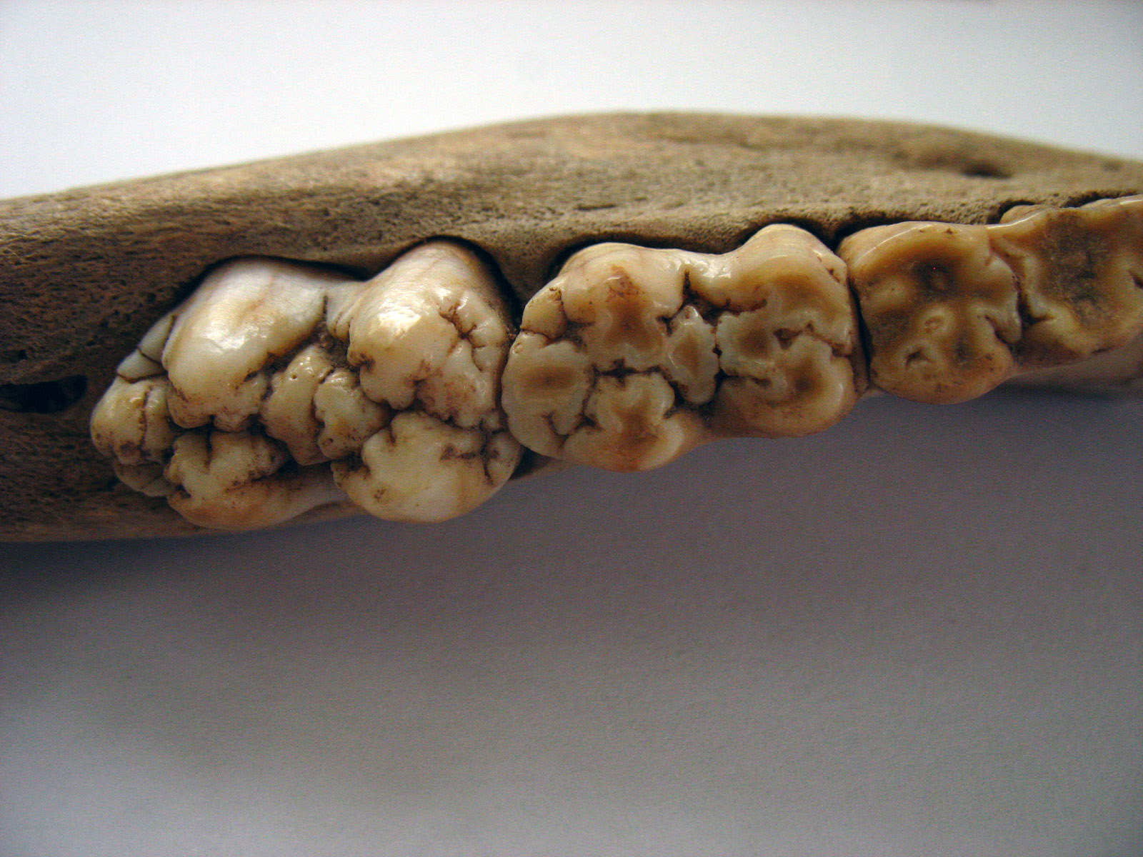
    Detail of the jaw with teeth of an approximately one-year-old domestic pig.

    Human nutrition in the medieval city (13th - 15th centuries), his relationship with animals and some features of animal production can be reconstructed with the help of the results of the archaeozoological analysis of animal bones and teeth and the analysis of some stable isotopes (carbon, nitrogen and oxygen). Important reservoirs of animal remains include archaeologically investigated waste objects in the urban environment. The systematic study of animal skeletal material and the linking of data obtained from multiple files provides more comprehensive information, e.g. about species diversity or the distribution of animals. The utilitarian focus of animal husbandry can be inferred from slaughter distributions. By linking the results of the slaughter age of animals, seasonality, nutrition and feeding regime, the strategy of animal husbandry and the timing of agricultural activities during the year can be approximated.

    Livestock as an indicator of socio-economic changes in medieval Prague

    The team from the Laboratory of Archaeobotany and Palaeoecology of the Faculty of Science of the USB, led by Lenka Kovačíková, published a study in one of the best-rated international journals, Archaeological and Anthropological Sciences, dealing with the isotopic signal in the bones of domestic animals from the archaeological finds of medieval Prague cities.

    The continuous development of the settlement of Prague from the 9th to the 14th century presents a challenge for tracking changes in animal husbandry during the Early and High Middle Ages. But how to grasp such a topic? One possibility is to look in detail at animal teeth found during archaeological research and their isotopic composition.

    It follows from previously collected archaeozoological data that the consumption behavior of the inhabitants of Prague changed at the beginning of the High Middle Ages - in the 13th century. But was this change, which is attributed to a wider medieval socio-economic transformation, also reflected in livestock farming?

    The results of the analysis of stable isotopes of carbon (δ13C) and nitrogen (δ15N) contained in the collagen of the roots of the teeth of cattle, domestic pigs, sheep and goats from osteological collections from three different parts of Prague (Malá Strana, Prague Castle and Old Town) indicate that the medieval transformation manifested itself in animal husbandry, breeding management and feeding regime changed over time. The early medieval model of extensive animal husbandry at the level of smaller estates in the Prague agglomeration grew into a more advanced system of supplying the city with livestock from elsewhere, e.g. via markets. The increase in δ15N values ​​in the teeth of pigs indicates not only a change in the feed intake, but also the gradual movement of pigs from the countryside to barns. Isotopic changes in the dental collagen of high medieval cattle, compared to the previous period, can signal changes in the agriculturally used landscape, e.g. more intensive fertilization of pastures and fields.

    • Kovačiková, L., Trojánková, O., Starec, P., Meduna, P., Limburský, P. 2020. Livestock as an indicator of socioeconomic changes in Medieval Prague (Czech Republic). Archaeological and Anthropological Sciences https://doi.org/10.1007/s12520-020-01229-5
  • Archaeobotany of the Neolithic tell of Vrbjanska Čuka, North Macedonia

    In the years 2016-2018, LAPE staff and students of Faculty of Science and Faculty of Arts at USB participated in the archaeological research of the Vrbjanska Čuka settlement (tell) in Pelagonia (North Macedonia), in cooperation with the Center for Prehistoric Research Skopje, the Institute for the Protection of Cultural Heritage Prilep and the Institute for Old Slavic culture of Prilep. The locality contains rich archaeological layers from the Neolithic, Ancient and Early Middle Ages periods.

    vrbjanska_cuka_2

    The subject of archaeobotanical sampling was mainly floor layers, internal structures and stone artefacts from the building dated to the Neolithic period (in this case around 5800 BC). The aim of the analyzes is to contribute to the knowledge of the economic habits of the first farmers in this area, which is, among other things, important from the point of view of understanding the adaptations of agriculture on the way from the Middle East to continental Europe. For three seasons, the participants of the Archaeobotanical Summer School, together with their Macedonian colleagues, sampled, sailed and sorted the obtained material, which was subjected to the analysis of plant macroremains, carbons, starch grains, phytoliths and malacofauna (in collaboration with L. Juřičková, Faculty of Science, Charles University in Prague).

    Published research results to date have provided information on a wide range of useful plants and species accompanying their cultivation (and several other botanical species), phytolith analysis provided evidence of grain processing and handling of plant material on the estate. The composition of the malacofauna also enables the reconstruction of natural conditions at the site and in the immediate vicinity to a certain extent. However, due to the significant disturbance of the oldest layers, these results are probably distorted and indicate the composition of the plants grown in the mentioned younger periods. Analyzes now continue on material from Neolithic contexts. Above all, we focus on newly discovered structures, which are believed to have been used for the storage of cereals or the preparation of plant food.

    www.vrbjanska.cip-cpr.org

    • Beneš J., Naumov G., Majerovičová T., Budilová K., Bumerl J., Komárková V., Kovárník J., Vychronová M., Juřičková L. (2018): An Archaeobotanical Onsite Approach to the Neolithic Settlements in Southern Regions of the Balkans: The Case of Vrbjanska Čuka, a Tell Site in Pelagonia, Republic of Macedonia. IANSA IX/2, p. 121 - 145. DOI: 10.24916/iansa.2018.2.1
  • Before the Neolithic: A contextual analysis of environmental dynamics during the early postglacial transformation of Central Europe

    GA ČR 13-08169S (2013-2017)

    After the end of the last glacial maximum, the ranges of many biological taxa changed dramatically. The primary cause was climatic changes caused by changes in the Earth's orbital parameters. We now have solid global palaeoclimate models for the key transitional period between the last glacial and the Holocene (roughly 18,000 to 7,000 years before present). However, what we currently lack are reliable analyzes of the impact of relevant climate changes on habitat diversity, biota and human population on the territory of continental Central Europe. At the same time, the latest findings show the extraordinary importance of this area for the development of the biological and cultural diversity of the entire European subcontinent. Considering these, the lack of reliable and mutually confronting evidence is particularly worrying. Our project aims to fill this gap. For this purpose, we propose broadly conceived interdisciplinary research of palaeoecological records at reference sites that were carefully selected in advance in the territory of the Czech Republic.

  • Archaeo-environmental research in Netolice - the turn of the early and high Middle Ages

    From the beginning, bioarchaeological research was part of the soundings that were carried out in the years 2007-2012 at the site of Na Jánu in Netolice (the center of power of South Bohemia from the 10th to the 13th century) as an annual summer archaeological practice lasting several weeks for students of the Institute of Archeology of the Faculty of Arts at the University of South Bohemia. The aim of the investigation of the small-area probes S6-S9 was to expand knowledge about the acropolis of the fort and to obtain stratified early medieval material, including sets of animal bones, while the evaluation of the osteological set is the subject of the assigned bachelor's thesis, and plant macroremains from washed-up samples. In probe S10, the remains of the early medieval to modern church of St. John the Baptist. Part of the interior of the church and the cemetery were examined. In addition to the documented skeleton graves, animal bones were discovered and many samples from grave fills and layers inside and outside the church were washed away (the obtained set of plant macroremains is processed in the form of a bachelor's thesis). Samples were also taken for pollen analysis, which is also the topic of the bachelor's thesis. The small-area probes S12, S13 and S14 were supposed to determine the presence, power and potential of archaeological situations in the area of ​​the supposed forecourt of the fort. From these probes, samples were taken for flushing as well as vertical blocks of sediment (pollen analysis and micromorphological analysis will be performed).

    The reference file for the hillfort (seat of elites) is a file obtained during the rescue archaeological research of a similarly dated settlement located in the area of ​​today's nursing home "Pohoda" in Netolice. A comparison of data from both researches could contribute to the study of the palaeoeconomy of the early medieval economic unit, especially to the clarification of food strategies (structure of cultivated cereals, composition and productivity of animals, direct evidence of meat consumption of domestic and hunted animals, etc.). The set of plant macroremains and bones is processed in the form of bachelor theses.

    The bioarchaeological approach is not only applied in the research of the acropolis, the adjacent forecourts and the settlement under the fort. In recent years, samples have also been taken in the immediate and more distant surroundings of the fort, to place the early medieval settlement in a wider landscape context. Targeted sounding (dug probes and boreholes) was thus carried out to collect samples in the floodplain of the Rapačov stream. The profiles obtained from the streambed could help to solve the question of how this early medieval center influenced the surrounding landscape and whether this influence can be registered and interpreted in the environmental record. In the layers with an admixture of organic material, we expect the preservation of information in the form of pollen grains and macroresidues, and we assume that it will be possible to monitor changes in the natural environment in the immediate vicinity of the fort (e.g. differences in agricultural production, changes in the structure of the forest, etc.).

  • Research on Národní třída, Prague - parasitological survey

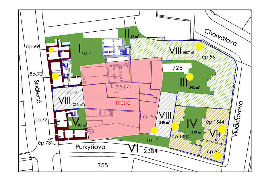
    The archaeological research site is located in the historic center of Prague on the border of the Old and New Towns of Prague. It is situated between Spálená, Purkyňova, Vladislavova and Charvátova streets. Specifically, it is a salvage archaeological investigation, on the area of ​​which a New Town block of flats was located. The original urban development existed here until the end of the 1970s (1979), when it was demolished due to the construction of the Národní třída metro station. Before the construction of the subway, rescue archaeological research was carried out by Olmerová.

    narodnitridaplan

    Map of the archaeological site, Národní třída, Prague. The approximate location of the investigated objects is marked in yellow.
    (Source: http://www.archeopraha.cz/index.php?cid=283&lb=a)

    The oldest part of the site is part of the early medieval settlement of St. Martin’s Újezd, which was documented here already in 1140. During the reign of Wenceslas I in the 1330s, the settlement was divided by the old town walls, which were built at that time. Several sunken objects and a part of a half-earthen house were discovered here from this settlement, which are ceramics dated to the 12th - 13th centuries. century.

    An important historical milestone for the construction boom in this place was the founding of the New Town of Prague by the Czech king and Roman emperor Charles IV. It was founded by a charter issued in March 1348.

    In addition to house construction, several above-ground and sunken, brick or mixed constructions of an economic or sanitary nature (wells, cisterns) should also be associated with the medieval and early modern building boom.

    Spálená street was home to one of the oldest houses of craftsmen, together with the Horse Market (today's Wenceslas Square). According to historical sources, Kovářská street, later Flašnéřská street, and today Spálená street, was a center of locksmiths, boilermakers, cutters, nailers, goldsmiths, but mainly there were blacksmith workshops. This fact was supported by findings during archaeological research, which prove the daily craft activity of the residents. Fragments of ceramic and glass containers, bones (belonging to both kitchen and craft waste), or hundreds of lumps of slag (metal and iron production) were found here.

    From the parasitological point, samples from a total of 9 objects were examined (mainly wells/sinks, then fillings of defunct buildings).

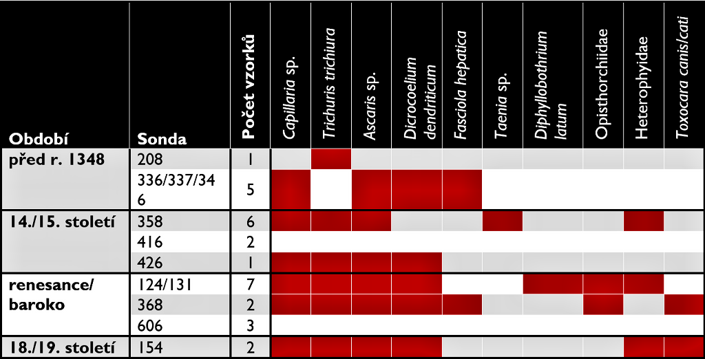
    Overall, the samples from this locality are among the rich in terms of the species composition of parasites (10 species), but in terms of the number of eggs found, they are among the poor (Table 3). 72% of the samples were positive for parasites. The species composition of parasites is comparable to medieval sites from both the Czech Republic and other European countries.

    Image_2

    Representation of parasites in individual time periods. In red – a positive finding.

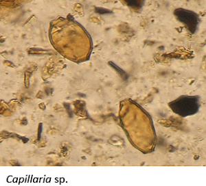
    Eggs of Capillaria sp. most probably indicate the presence of rodents, in which this parasite is common, and whose presence in cities is more than likely. Eggs of this parasite were found in almost all samples. This parasite is transmissible to humans and other mammalian species.

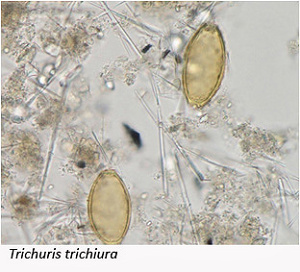
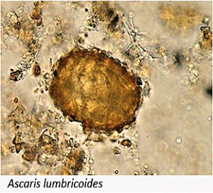
    Trichuris trichiura and Ascaris sp. are parasites transmitted by the fecal-alimentary route and are typical of places with low hygienic conditions (relative standard for the Middle Ages).

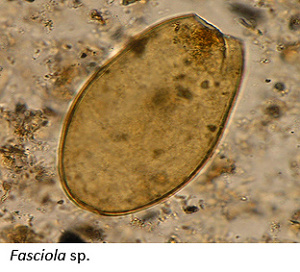
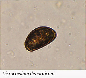
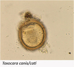
    In the case of Dicrocoelium dendriticum and Fasciola hepatica eggs being found, it could either be pseudoparasitism caused by eating meadow plants, for example, or they could be of animal origin. Eggs of Toxocara canis/cati indicate the presence of dogs or cats.

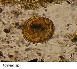
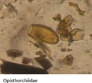
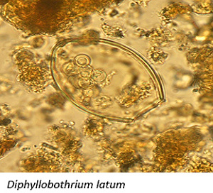
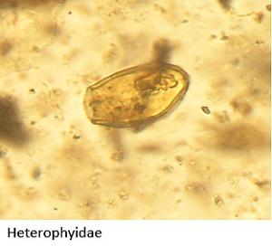
    Two species of tapeworm were found in the samples. The eggs of the tapeworm Diphyllobothrium latum are probably of human origin, and infection usually occurs by eating raw fish. The occurrence of tapeworm eggs (Taenia sp.) in archaeological material is relatively rare and indicates the consumption of poorly heat-processed meat (beef, pork). Records of its occurrence come mainly from medieval French sites. Eggs of the families Opisthorchiidae and Heterophyidae were also found, in which it is not possible to decide whether they are of human or animal origin, e.g. birds.

    Image_3 Image_4 Image_5 Image_6 Image_7 Image_8 Image_9 Image_10 Image_11 Image_12

  • Bioarchaeology of South Bohemia

    GA JU 116/2013/P (2013-2015)

    The project managers are trying to establish or deepen cooperation with the archaeological workplaces of South Bohemian museums with the aim of revising and analyzing the bioarchaeological material stored there and publishing the gained knowledge. The project, which is primarily based on interdisciplinary cooperation (anthracology, macroremains analysis, dendrochronology, paleoparasitology, palynology, archaeozoology, etc.), tries to point out that South Bohemia represents a suitable environment for the application and development of environmental-archaeological methods. South Bohemian archaeological research is developing a methodology for sampling different types of contexts for bioarchaeological analyses, which is applicable not only on a regional scale. During the implementation of the project, which is mainly attended by master's and doctoral students from the University of South Bohemia, the emphasis is, for example, on monitoring the interactions between man and the landscape in the past (from prehistoric times to modern times), capturing regional specifics in plant and animal production, revealing changes in the landscape (e.g. the consequences of deforestation, the spread of agriculture), approximation of the health status of people and animals, revealing preferences in the use of wood, etc.

    Collaborating institutions:

    • South Bohemian Museum in České Budějovice
    • Prácheň Museum in Písek
    • Museum of Central Pootaví Strakonice
    • Prachatice Museum
    • Milevsko Museum
    • Department of Archaeology, Faculty of Arts, University of West Bohemia
    • Museum of West Bohemia

    Presentation of the project at meetings and conferences (selection)

    • Houfková, P., Pták, M., Jiřík, J., Baudyšová, J., Bešta, T., Komárková, V., Kodýdková, K., Vaněček, Z., Stehlíková, E., Majer, A., Beneš, J., Divišová, M. and Šálková, T. 2013. Archeobotanical evidence of human impact within the area of Pisecke mountains, Czech Republic. 16th Conference of the International Work Group for Palaeoethnobotany, 17-21.6.2013, Soluň, Řecko.
    • Kodýdková, K., Beneš, J., Frolík, J., Musil, J., Kozáková, R., Bartošová, L., Baloghová, R. and Kovačiková, L. 2013. Multi-proxy analysis of cesspit 938 from Chrudim, Czech Republic: dynamics of archaeobotanical and environmental record reflected in deep cesspit infill stratigraphy (14th – 18th century). 16th Conference of the International Work Group for Palaeoethnobotany, 17-21.6.2013, Soluň, Řecko.
    • Preusz, M., Beneš, J., Kočár, P., Kovačiková, L. 2013. What they ate, what they drank and of what? Look on daily life of the early modern burgess household in Český Krumlov town (Czech Republic). 19th EAA European Association of Archaeologists, 4.-8.9.2013, Plzeň, Česká republika.
    • Hlásek, D., Chvojka, O., Šálková, T., Kovačiková, L., Menšík, P. and Netolický, P. 2013. Evidence for Increase in Social Complexity in the Early Bronze Age in South Bohemia – Case study: The Vrcovice Hillfort 19th EAA European Association of Archaeologists, 4.-8.9.2013, Plzeň, Česká republika. Chvojka, O., Šálková, T., Zavřel, P. 2013. Archäobotanische Untersuchungen in vorgeschichtlichen Siedlungen Südböhmens. Archäologische Arbeitsgemeinschaft Ostbayern/West- und Südböhmen/Oberösterreich, 19-22.6.2013, Kostenz, Německo.
    • Pták, M., Stehlíková, E., Koppová, E., Fröhlich, J., Šálková, T., Jiřík, J. 2013. Attemp to dendrochronological dating of the medieval gold-ore processing mill founded in Stará Pazderna location, Písek. Archäologische Arbeitsgemeinschaft Ostbayern/West- und Südböhmen/ Oberösterreich, 19-22.6.2013, Kostenz, Německo. Uhrová, K., Houfková, K., Beneš, J. 2013. Late glacial vegetation development of the South Bohemian Basin (Czech Republic). 9th International Pollen Monitoring Programm (PMP) Meeting, 26.-30.8.2013, Praha, Česká republika.


  • Paleoecology of Svalbard

    LAPE is also connected with the Center for Polar Ecology, which has been working for several seasons on the Svalbard archipelago - in the central part of the island of Svalbard. Among other activities, we research the development of lakes in the vicinity of the field station (Billefjorden, Petuniabukta bay) and research the development of terrestrial ecosystems (mainly the emergence and development of vegetation on marine terraces).

    Most of the lakes on the island are quite young, mainly because they are located on marine terraces that have only recently been raised above sea level. However, there are also lakes here, the age of which goes back further into the past. Currently, we have taken profiles from about six younger lakes (from the middle-younger Holocene), and one from Lake Gramaksla, which was probably formed at the beginning of the Holocene, which are gradually being processed.

    At LAPE, we provide dating of the sediment, analysis of plant macroremains and pollen analysis of the sediment.

    • Bernardová A. et Košnar J (2012): What do Holocene Sediments in Petuniabukta, Svalbard reveal? Polish Polar Research 33/4: 329–346.
    • Klimešová J., Prach K., Bernardová A. (2012): Using available information to assess the potential effects of climate change on vegetation in the High Arctic - North Billjefjorden, central Spitsbergen (Svalbard). Ambio: 41:5 435-445
  • Upper Moravian Basin

    Holocene dynamics of the Upper Moravian Basin ecosystem as a key to understanding the process that influenced the creation of the current landscape mosaic. GAČR 13-11193S (2013 – 2016)

    The Holocene development of the vegetation of the European lowlands is influenced by the interaction of natural and cultural processes. The Upper Moravian Basin is one of the key lowlands in Central Europe. This biogeographical corridor enabled the spread of the organism from the southern refugia to the Czechia and then to Poland, as well as the early arrival of Neolithic agriculture. The project tries to reveal the main causes that led to the formation of the landscape mosaic, using multi-proxy paleoenvironmental analyses. Our team has been studying the Upper Moravian Valley for a long time. Most of our studies have not yet been published. Vegetation development at the regional level will be obtained by REVEALS by calibrating the result of the pollen analysis. In the second step, the combination of the result of the in-situ methods (macroresidues, carbon and wood remains) will be compared at the local level with the LOVE calibration of the pollen record. Attention is also paid to changes in the aquatic environment in the past, which will be reconstructed using diatom transfer functions. Land settlement models will be created based on archaeological data.

    Project goals:
    • Objective interpretation of the results of many already performed archaeobotanical analyses
    • Modeling and reconstruction of the Holocene vegetation dynamics of the region
    • Synthesis and interpretation of paleoenvironmental and archaeological data
    • Assessment of the development of the region's vegetation in relation to the Pannonian plain

    Image_1 Image_2

  • The historical archeology of global trade networks with plant taxa

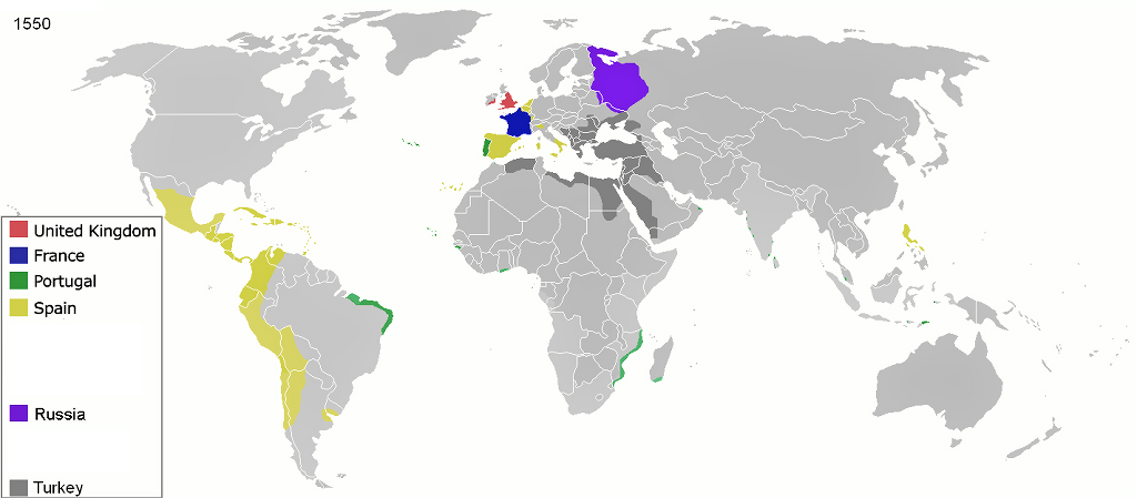
    The study of trade networks with plant taxa in historical epochs is one of the key research topics of the Center for the Study of Man and Plants of Europe and North Africa of the Ice Age - PAPAVER. The purpose is to study the transfer of selected plant taxa in a wide geographical gradient from Asia through Africa to Europe in the early modern period (ca. 1500 – 1800 AD) through the comparative lens of global historical archeology and archaeobotany. The aim is to trace two basic levels of global trade in the early modern period: 1 – production and global transfers; 2 – local consumption.

    At the same time, on a theoretical level, we understand globalization as the early modern process of spreading cultural elements around the world, not only artifacts, but also ecofacts! According to historical archaeologists, globalization is related to the beginning of European expansion in the 15th century, which involved a targeted expansion of power and the creation of a new economic system that incorporated unequal, clientelist social relations usually organized around material culture, artifacts, or ecofacts. The trade connections of one place with another (core – periphery, or semi-periphery) have their roots in the developed European economy, so they could incorporate a lot of personal dependencies and start a wholesale cultural exchange between continents.

    On the contrary, we perceive local consumption in the context of the birth of early modern society, in which, from an economic point of view, producers supplied consumers with goods. This was characteristic of mercantilism, later capitalism. Both aspects, which are closely related to the creation of global trade networks, allow us to understand the transformations of the European social and cultural system at the beginning of the modern age, as trade largely structured everyday life and influenced specific consumers. Therefore, archaeological and archaeobotanical findings as the product of specific historical actors reflect the penetration of foreign plants into the everyday life of European early modern society, or the complex relationship between exotic otherness and domestic stereotype

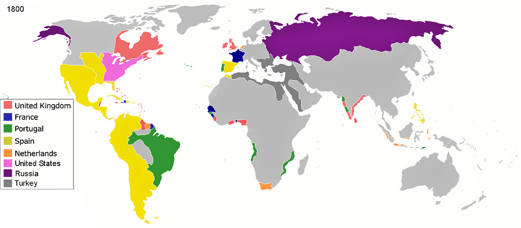
    colonisation_1550

    1550 BC. - „3 C“ in Historical Archaeology „Colonialismus, Capitalismus, Consum“ (http://en.wikipedia.org/wiki/Colonization)

    colonisation_1800

    1800 BC. - „3 C“ in Historical Archaeology „Colonialismus, Capitalismus, Consum“ (http://en.wikipedia.org/wiki/Colonization)

    Current Topics:

    • Global Spice Trade:
      The first part of the research is focused on the transfer of spices, which stimulated the taste sensuality of consumers in Europe and represented the most important trade item in the monitored area and period. He notes the complicated journeys of spices from Indian plantations to European dining tables. Ume combines specific archaeobotanical findings of plant macroremains of spices with archaeological results (e.g. sunken ships, waste layers) and historical data (e.g. maps, cosmographies, chronicles, herbariums). It leads to a comprehensive knowledge of specific practices in the cultivation of spices, monitoring of long-distance routes, ports and market centers, the specialization of merchants, up to the distribution of luxury goods among European consumers.

    • Exotic plants in collections from Central European localities (Czech Republic)
      The second specific topic is research on the representation of exotic plants in medieval and early modern waste layers, which reflect the penetration of exotic plant taxa among the broadest strata of society in Central Europe, respectively. in the territory of the Czech Republic. A modest example is:
      Historical-archaeological research of town house No. 55 on Latrán in Český Krumlov
      The South Bohemian town of Český Krumlov, which is one of the Renaissance and Baroque jewels of the Czech Republic and is included in the list of UNESCO monuments, is surprisingly one of the least known localities from an archaeobotanical point of view. Therefore, a detailed analysis of plant macroremains, which presented not only a wide spectrum of local plant taxa, but also some exotic species, became an important goal of the comprehensive historical-archaeological study of the filling of the well of the town house No. 55 in Latrán (Preusz – Beneš – Kočár 2014). Among the most interesting is the finding of macroremains of the common gourd "Cucurbita pepo". Although it is one of the oldest cultivated plants in the world, it first came to Europe from Central America during the great overseas discoveries. The specimen from Český Krumlov is still the third evidence of the penetration of the gourd on the banquet tables of middle-class households in Bohemia and Moravia. Next to Český Krumlov, the gourd was recorded in the early modern waste layers of a sump from Kanovnická Street in Prague (Čulíková 2008) and the well of the brotherhood in Ivančice near Brno (Opravil 1985).

    Summary:

    The historical archeology of global trade networks of plant taxa provides an understanding of the modern world system, which emerged from the 16th century and largely influences the present. This system has three basic pillars. The first is the rapidly developing economy, in the form of mercantilism and capitalism. Secondly, it is the emergence of superpowers, which began to profess expansionist world politics and colonization. Ultimately, it is a new social relationship between producer and consumer. Archaeological or archaeobotanical finds of exotic plant taxa in this context do not become only a purely local aspect, but acquire a global dimension that influenced society and culture in the early modern period.

    • Šálková T., Chvojka O., Hlásek D., Jiřík J., John J., Novák J., Kovačiková L. Beneš J. (2019): Crops along the trade routes? Archaeobotany of the Bronze Agein the region of South Bohemia (Czech Republic) in contextwith longer distance trade and exchange networks. Archaeological and Anthropological Sciences 11, p. 5569–5590. https://doi.org/10.1007/s12520-019-00893-6

    Image_3

    Image on the cover of the Castor Durante herbarium: Herbario nuovo. Roma 1585 (Photo by M. Preusz).

    Image_4

    The Mexican "cucurbita pepo" was already in Český Krumlov in the first half of the 17th century
    (http://digilander.libero.it/felrig/photos/cucurbita_pepo.htm)

  • Santa Severa - Archaeobotanical research of the Etruscan port of Pyrgi, Italy

    In September 2013, the practical part of the collaboration of the Laboratory of Archaeobotany and Paleoecology on the archaeological research at the site of the ancient port of Pyrgi, located in the Santa Severa, in Lazio region, Italy, began within the framework of the Papaver Center (Centre for the Study of Man and Plants of Europe and North Africa of the Middle Ages, 2013-2015). It is a joint project involving the Museum of the Sea and Ancient Navigation and the University La Sapienza of Rome. The Museum of the Sea in Santa Severa has been conducting land and underwater research of the port complex from the 6th - 5th century for many years. The employees of the Laboratory of Archaeobotany and Paleoecology are helping, as part of their internships in partner Italian institutions, with the archaeobotanical analyzes of the rare object of the waste well, which was discovered by the underwater archaeologist and director of the museum in Santa Severa, Dr. Flavio Enei, roughly 3 meters below the current sea level.

    The local ancient port and Etruscan city from the 6th - 5th centuries BC, Pyrgi, famous for the discovery of gold plates that made it possible to decipher the writing of the Etruscans, lies two-thirds on the sea coast, but its western third was flooded by the Mediterranean Sea in the last 2500 years. Part of the residential area of ​​the city and the ancient port facilities must be investigated using the methods of underwater archaeology. Members of the PAPAVER research center Veronika Komárková, PhD student Kateřina Kodýdková, Klára Paclíková and Jaromír Beneš are taking advantage of the rare opportunity to get to know Etruscan objects and Mediterranean plant material that bear witness to the diet and habits of the ancient inhabitants of Italy, who had a direct connection to the North African Phoenicians. In cooperation with experts from the Roman University La Sapienza, with which the Czech archaeobotanists have been working for many years, they are monitoring the cultural transmission of plants between the Mediterranean countries and Central Europe. The ancient port of Pyrgi is a site of documented contact between North Africa and Italy.

    Another site that our team in the Lazio area is investigating from the point of view of archaeobotany is the Roman villa of Castrum Novum, which in Roman times was located in the northern part of the present-day city of Santa Marinella. Samples were taken from the building of the Roman villa for various types of archaeobotanical analyses.

    • Kodýdková K., Beneš J., Komárková V., Paclíková K. (2013): Pilot Archaeobotanical analysis of the sediment the well 112 in Pyrgi, Santa Severa. Archaeologia Maritima Mediterranea (10), p. 181 – 188.
    • Enei F., Nardi-Combescure S., Poccardi G., Beneš J., Galletti M., Kodýdková K. , Lureau A., Paclíková K., Preusz M. et Squaglia A., (2015): Castrum Novum (Santa Marinella, prov. De Rome).  Chronique des activités archéologiques de l’École française de Rome, Italie centrale, URL: http://cefr.revues.org/1364

    dsc09381red
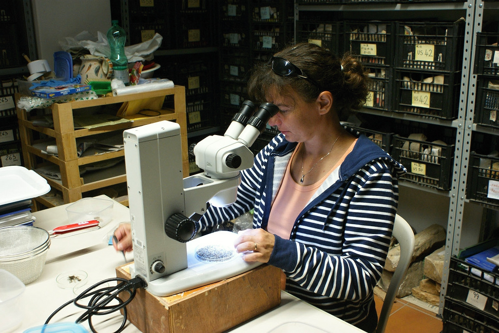
    Veronika Komárková sorts archaeobotanical material.

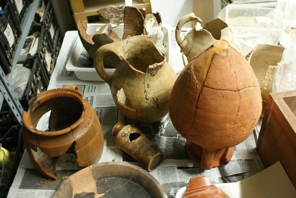
    dsc09382redCeramic vessels from the Etruscan period from the well whose contents we are analyzing.

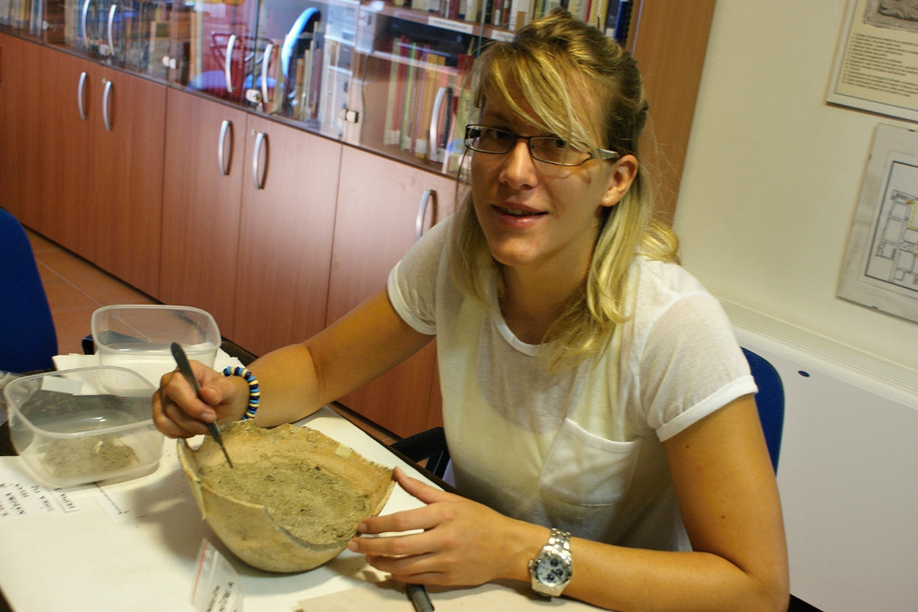
    dsc09389redKlára Paclíková analyzes the sediment of one of the vessels with a preserved filling.

    dsc09413redThe ruins of the extinct Etruscan port of Pyrgi are located partially below sea level.

  • Neolithic houses from Hrdlovka, NW Bohemia - changes in shape and meaning

    GA ČR P405/12/2173 (2012-2014)

    As part of the project, which is held by the Institute of Archeology, Faculty of Arts, University of South Bohemia, LAPE (archaeozoologist Ing. Lenka Kovačiková, Ph.D.) performs an analysis of animal bones collected from the fillings of Neolithic objects. Although archaeozoological analysis deals with a higher degree of damage to osteological material, it focuses not only on revealing taphonomic differences between subsets from individual objects, but also on the interpretation of species representation, distribution of anatomy, age, sex, etc. The goal of analyzing a wide range of data resulting from the determination is not only to show what was the subsistence strategy of the inhabitants of Hrdlovka, but also to what extent they were economically self-sufficient in the various phases of the settlement, whether they used hunted animals or other species, e.g. birds, fish, etc., to complete their diet of animal origin. A valuable source of information is also provided by the study of tools made from bones or a comparison of the main parameters of animal production in Hrdlovka in the context of other sites located in northwestern Bohemia (e.g. Vchynice, Hrobčice).

    • Beneš J. et al.: The Neolithic Site of Hrdlovka. České Budějovice: Nakladatelství Jihočeské univerzity v Českých Budějovicích; Most: The Institute of Archaeological Heritage of Northwest Bohemia, 2019.
    • Vondrovský V., Beneš J., Divišová M., Kovačiková L., Šída P. (2016): From LBK to SBK: Pottery, Bones, Lithics and Houses at the Neolithic site of Hrdlovka, Czech Republic. Open Archaeology (2), p. 303–327. DOI: 10.1515/opar-2016-0022
    • Vondrovský V., Beneš J., Rauerová M., Kovačiková L., Šída P., Divišová M. (2015): The Neolithic sites Hrdlovka and Hrobčice in the context of stroked pottery culture in Northwest Bohemia, Czech Republic. Anthropologie 53 (9), p. 457-471.

    Image_1

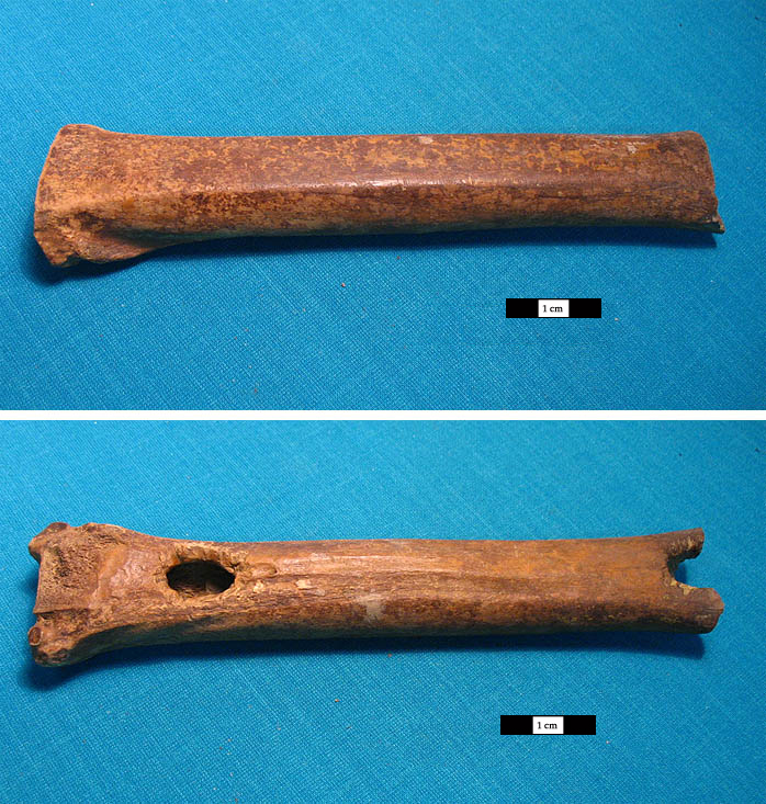
    Proximal part of the metatarsal bone of a aurochs (Bos primigenius) from the filling of object 261.

  • Paleoecological research on the shore of the Černiš pond

    What secrets do Vrbenské rybníky hide?

    vrbenaky-2008

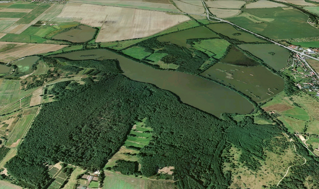
    Aerial view of the nature reserve Vrbenské rybníky, alder at the Černiš pond; © Geodis Brno 2008 and Google 2013.

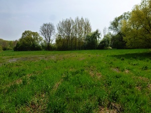
    A few kilometers from the historic center of České Budějovice lies the nature reserve Vrbenské rybníky, which is, among other things, a unique occurrence of extensive wetland alder. This biotope is most represented on the southern shore of the largest of the ponds present, called Černiš. The organic sediments found in this area offer a high potential for the preservation of pollen grains and spores, therefore a soil profile intended for palynological processing was taken here in September 2010 as part of Kristina Uhrová's bachelor's thesis under the supervision of Petra Houfková. Pollen analysis was supported by radiocarbon data, measurements of organic carbon content and geochemical analysis. The analysis of plant macroresidues (Jitka Kosňovská), carbons (Jan Novák) and diatoms (Jan Bešta) will be added to the research.

    Based on radiocarbon data, it was found that the continuous development of the vegetation on the given site has been recorded since the Late Glacial period, the very base of the profile is dated to the Alleröd period. However, part of the sediment corresponding to the Holocene, which follows the Preboreal, is missing due to the presence of a stratigraphic hiatus. The ascending part of the profile then captures the subrecent pollen spectrum. A similar problem can be observed in other locations in southern Bohemia.

    cernis

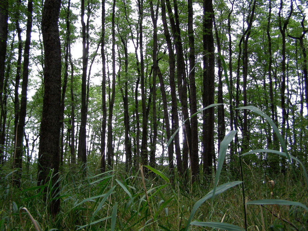
    Wetland alder on the southern bank of the Černiš pond; photo: K. Uhrová.

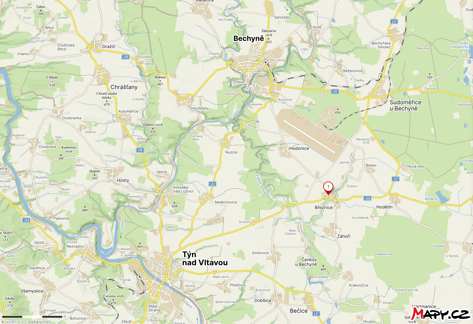
  • Březnice

    The settlement from the Younger Bronze Age (HaA2) in the cadastre of the village of Březnice (Tábor district) is located on the ridge of a conspicuous hill, in an advantageous strategic position, the elevation above the surrounding terrain is around 30 m.

    mapy

    The settlement disturbed by deep plowing was discovered by J. Beneš, J. Boček, J. Ernekr from Bechyně during surface collections in August 2005. Since then, the disturbed settlement has been subject to rescue research by the Museum of South Bohemia in České Budějovice every year, followed by research by the Institute of Archeology of the Faculty of Arts University of South Bohemia in the form of summer internships.

    Image_4

    Several types of objects were captured on the settlement (ordinary settlement and storage pits, stake pits), typical objects are the so-called gutters, i.e. objects of linear shape, oriented in the north-south direction. The troughs are filled with large quantities of pottery, mostly fired, clay weights and stone artifacts. Objects of this type are typical for the younger and late Bronze Age in southern and western Bohemia, Austria and southeastern Germany.

    Image_2 Image_3

    From the objects, samples were taken from all fillings, systematically from different parts of the given object. The samples were floated by the flotation method. Above all, there is a visibly very high concentration of macroresidues of useful plants in the gutters.

    Image_5

    Of the macroremains of useful plants, millet and barley predominate, sown wheat, einkorn, spelled, lentils, peas and broad beans were also documented. Among the macro-residues of weeds/ruderals, white merlin, common sedge and common sedge predominate.

    Image_6 Image_7

    Based on the analyzes carried out so far, it is possible to partially reconstruct the food strategy of the economic unit that used the investigated area in the Younger Bronze Age. Within the housing estate itself, it is possible to interpret the fillings of individual buildings and the functionally different features of the investigated area.

    • Šálková T., Vobejda L., Chvojka O., Beneš J., Vondrovský V., Kuna M., Křivánek R., Menšík P., Novák J. (2022): Extensive archaeobotanical data estimate carrying capacity, duration, and land use of the Late Bronze Age settlement site Březnice (Czech Republic). Scientific Reports 12(1):20323. DOI: 10.1038/s41598-022-24753-x.
  • Archaeological rescue research in the city of Mělník

    In 2009, the Institute of Archeology of the Academy of Sciences of the Czech Republic, Prague, v.v.i. with the Regional Museum of Mělník and in cooperation with the Laboratory of Archaeobotany and Palaeoecology of the University of South Bohemia in České Budějovice was conducting archaeological research during the events "Revitalization of the city of Mělník" and the construction of the connection of the port to the road I/16.

    It was a planned rescue archaeological research, which in terms of size is one of the most extensive archaeological probes on the territory of the castle and the town in the territory of Bohemia in the last 50 years. Its size can perhaps only be compared with similar research carried out at Prague Castle in the interwar period, or with the uncovering of Great Moravian hillforts in southern Moravia in the 1950s.

    The most interesting part of the construction of the new sewer from an archaeological point of view was the section in Česká street, around the entrance side gate and the original walls. Part of the exposed and examined area in the upper layer contained the oldest marl sewer. Below it, an intact section of the fortification system was captured in the extent of about 1.4 x 18.3 m and to a depth of about 3 m. Here we managed to capture the wall fortification from the 14th - 15th century – a moat filled in mainly with modern material from the 17th century onwards, a fence partially broken by a new sewer from the second half of the 20th century and a terrace by the access road to Česká street, a fortification system mainly from the 9th century, a residential building from the same period and a stone ground plan of the top medieval fort (so-called Luční brána) in the fence line of the fortifications.

    Thanks to rescue archaeological research in Česká Street, the early medieval settlement, whose beginnings fall into the 8th-9th century, was specified. In the 9th century, Mělník was fortified with a wall for the first time and became a hillfort, and its area was approximately 11 hectares. In addition to archaeological situations (fortifications and relevant settlements), we also obtained rich botanical and osteological material from the investigated section.

    During the construction of the connection of the road I/16 to the port of Mělník, a part was already led in the previously broken section by the original construction of the road I/16. Unfortunately, the remaining part was only explored up to the subsoil level, because the construction of the road did not allow for deeper excavation.  Despite this deficiency, when in fact only the youngest objects from mainly the early Middle Ages were captured in this layer, a total of 133 objects of various mainly economic nature were discovered. It details the flourishing of the Mělník sub-castle, in today's Pšovce, in prehistoric times - the Neolithic period and in the period from the 11th to the 13th century, when a craftsman's settlement was located here, about which we have only minimal written information.  The settlement, which probably already had a Romanesque sanctuary in the vicinity of the later early Gothic St. Lawrence church and monastery, ended its existence in the 13th century, when a royal city was established on the hill.  In addition to ceramics, grease, charcoal, osteological and botanical material was also obtained from the captured housing objects, mainly ovens.

    The subsoil of Mělník area is made up of chalk sediments, which are suitable for preserving the original malacofauna. Preserved shells of molluscs bear witness to the use of the site in the past.

    Fossilized mollusk shells - the malacocenosis - mainly consist of the following species: Truncatellina cylindrica, Vallonia pulchella (lovely vallonia), V. costata, and Vertigo pygmea (crested vertigo) or Pupilla muscorum (Moss Chrysalis snail or widespread column). All these species belong to the same ecological group of xerothermic gastropods inhabiting herbaceous formations in dry or slightly moist and warm habitats on unconsolidated calcareous sediments.

    The results of the botanical macroremains analysis showed the main assortment of cereals cultivated in the early Middle Ages. The most important cereals are wheat and barley, proso millet (Panicum miliaceum) and its substitutes, such as barberry (Setaria sp), were also of great importance, at least in the early Middle Ages. The spectrum of field weeds is also very interesting, which is evidenced by today's almost extinct, but formerly abundant species, such as for example common corncockle (Agrostemma githago), hare's ear (Bupleurum rotundifolium), blue woodruff (Asperula arvensis), and Polycnemum major.

    The aim of the macroremains analysis was to document the cultivation of vines in the early Middle Ages. Thanks to the discovery of a charred stone of a grape vine, it can be assumed that there was a winery in Mělník in the early Middle Ages, and in a way this confirms the legend according to which the winery was founded here by Saint Ludmila with Bořivoj at the end of the 9th century. The above-mentioned weeds, which are often found even in vineyards, can strengthen this theory, but they cannot be taken as direct evidence.

    The results of the anthracological analysis show the presence of two different types of samples. There are less numerous samples with a species-varied composition, which probably reflect the character of indiscriminately collected firewood. On the basis of the species composition of these samples, it is possible to reconstruct the presence of relatively intensively affected vegetation with an abundant presence of light-loving and early successional tree species in the vicinity of the wood in the immediate vicinity of the site. There was probably a rich mosaic of forest-free areas, pastures, vegetation and enlightened oak forests managed with stumps. The presence of the nearby Elbe alluvium is indicated by the relatively abundant presence of poplar/willow. The second type of samples are contexts with the occurrence of one or two tree species (oak or pine). It is likely that it could be the destruction of buildings, and the wood of these trees was used as a construction material. The wood used for the construction of the buildings was selectively chosen. Given the ecological characteristics of the immediate surroundings, it is not excluded that there were also imports from the wider surroundings of Mělník. The transport of beech wood can be considered in a similar way.

    From the results of analyzes of mollusk shells, plant macroremains and carbon, we can conclude that it was a deforested mosaic landscape where both anthropogenically influenced habitats and steppe enclaves were found in close proximity.
  • Domica (NP Slovak Krast)

    In 2008, we were approached by our colleagues Václav Krištůfek and Dana Elhottová from the Institute of Soil Biology of the Academy of Sciences of the Czech Republic in České Budějovice, that the Laboratory of Archaeobotany and Palaeoecology of the Faculty of Science of the University of South Bohemia (Jaromír Beneš, Jan Novák) in cooperation with the Department of Plant Physiology of the Faculty of Science of University of South Bohemia (Jiří Šantrůček), Institute of Botany Academy of Sciences of the Czech Republic in Průhonice (Helena Svitavská-Svobodová) and the Institute of Systemic Biology and Ecology (Kateřina Křováková) dealt with the palaeoecological use of a unique pile of thousand-year-old bat guano in the Domica cave in the Slovak Karst. In the conditions of the cave, the guano content retain its structure even after more than a thousand years due to the low pH (3.2) and the extremely high content of heavy metals (Pb, Cu, Hg and others). Microorganisms are not very active in this environment, and thanks to this, the guano does not decompose and accumulates in a pile more than one meter high and three to four meters wide today.

    According to current knowledge, the development of the surrounding landscape from the time of the Great Moravian Empire to the present is recorded in the sediment profile. Preliminary sampling and its palyno and isotopic analysis indicated serious landscape changes starting from the wet phase of the early Middle Ages, through the medieval climatic optimum, the Little Ice Age and the present day. In the first days of May 2009, J. Novák and the authors of this report took a new profile directly in the cave. We expect the new samples to significantly refine the previous results, especially to capture continuous development.

    Apart from the "cave" activity, during our stay in the Slovak Karst, we managed to find and drill a Holocene profile in an open landscape in a valley not far from Domica. If his palaeoecological analysis is successful, we will have a unique opportunity to compare the development in the open landscape of the Slovak Karst and the record reflected in the food chain of bats in Domica. The Domica cave became famous for the finds of a Neolithic settlement of the Bukovo Hora culture (approx. 5th thousand years BC). During our stay underground, we also managed to sample the layers related to the Neolithic settlement.

    • Svitavská-Svobodová H., Andreas M., Krištůfek V., Beneš J., Novák J. (2015): The thousand-year history of the Slovak Karst inferred from pollen in bat guano inside the Domica Cave (Slovakia). Folia Geobotanica 50(1).  DOI: 10.1007/s12224-015-9205-0
  • Vladislav Hall - archaeobotanical analysis of vault filling, Prague Castle

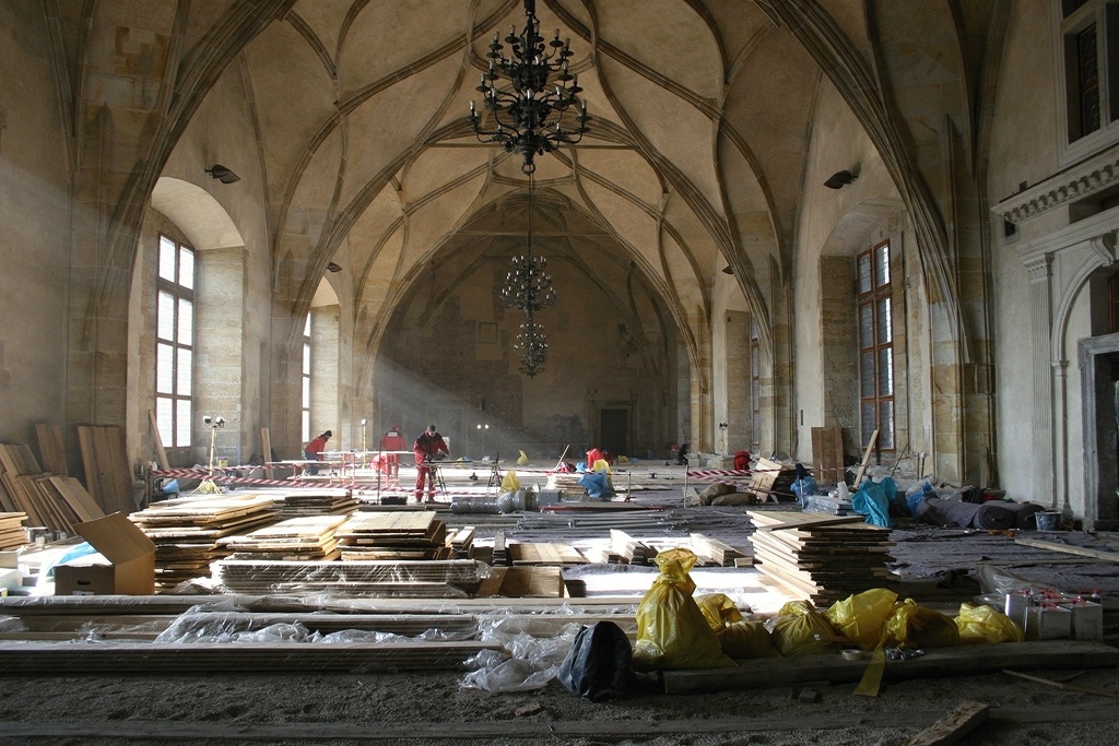
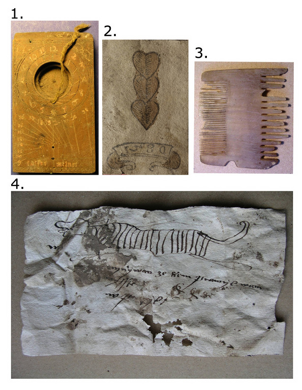
    The Vladislav Hall of Prague Castle, built in 1502, was a representative place for holding royal celebrations, feasts and trade in valuable goods. During rescue archaeological research, which took place as part of the reconstruction of the wooden floor from November 2008 to January 2009, vault fillings dating to the end of the 16th and 17th centuries were discovered. Vault backfills represent a unique set of specially selected dry waste material, such as hay, wood waste, sawdust and kitchen waste, providing insulation. A high proportion of artefacts and objects of daily use, such as wooden spoons, playing cards, knives, chemical balances and various manuscripts etc., is also significant.

    vladislavak-1

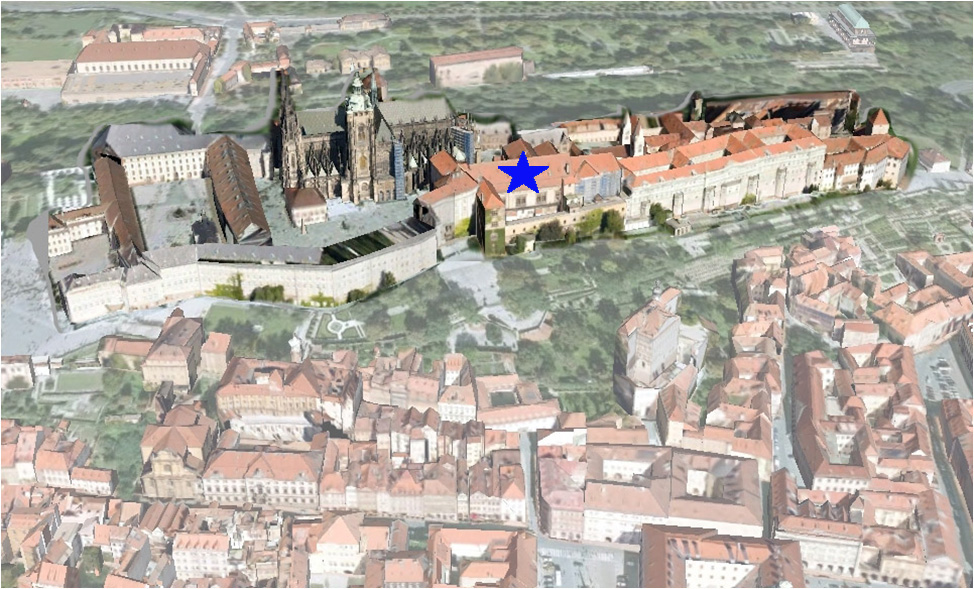
    Relief of Prague Castle, location of Vladislav Hall marked with an asterisk.

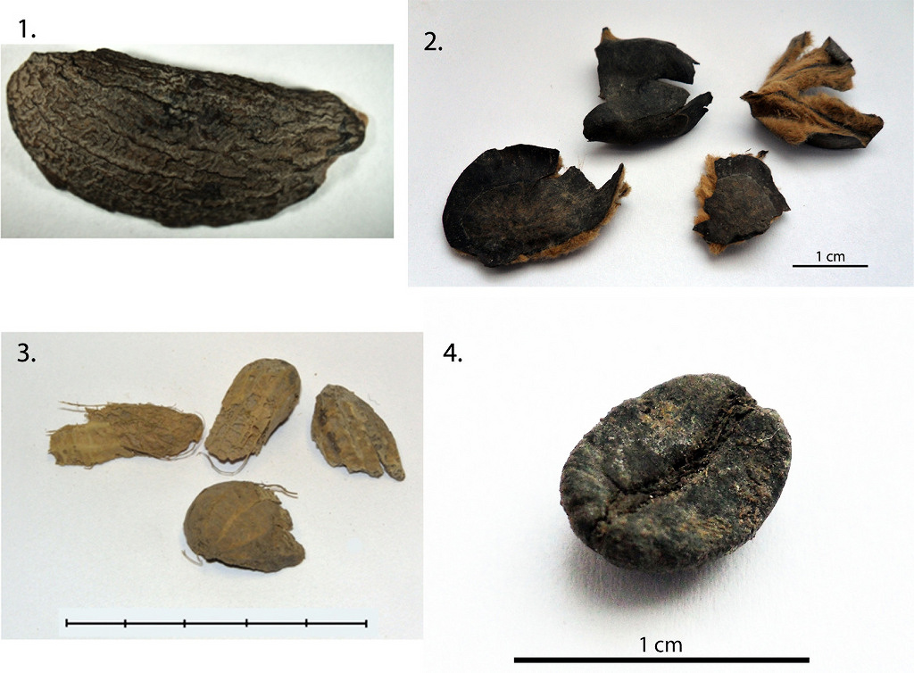
    The subject of archaeobotanical analysis was approx. 250 m3 of organic waste, which was separated by two methods, dry sieving and flotation method on the Ankara vessel. In addition to common finds of useful plants, 30 % were imported exotic species, some even for the first time in Central Europe. These are, for example, the coffee tree (Coffea arabica), carob (Ceratonia siliqua) and peanut (Arachis hypogaea), in which case it is even the first find in Europe. All these findings were separated using the dry sieving method designed to capture large plant macroremains, in this case mainly walnut and hazelnut shells, plums, cherries, wine, etc. Species such as the olive tree (Olea europaea), almond tree (Amygdalus communis), chestnut tree (Castanea sativa), pistachios (Pistacia vera), citrus (Citrus sp.), nutmeg (Myristica fragrans) and boxwood (Buxus sempervirens) were captured more rarely. The collection of plant macroremains captured by the flotation method corresponds to the common composition of early modern assemblages of useful plants with a significant component of imported crops.

    vladislavak-2

    A view of the Vladislav hall during archaeological research.

    Although the macro-residual analyzes are still ongoing, based on the results so far, we can already evaluate the position of Prague Castle at the turn of the 16th and 17th centuries as an important center of trade and culture. Thanks to the amount of luxury imported goods, Prague Castle has its specific character of a higher social environment, which was also identified in this way at several other places in Prague Castle and its immediate surroundings.

    • Beneš J., Čulíková V., Kosňovská J., Frolík J, Matiášek J. (2012): New Plants at Prague Castle and Hradčany in the Early Modern Period: a History of Selected Species. Interdisciplinaria Archaeologica. Volume III (1), p. 103 – 114. Doi: 10.24916/iansa.2012.1.7

    vladislavak-3

    A sample of the findings of plant macroremains from the vault backfill dated to the end of the 16th and 17th centuries: 1st: nutmeg (Myristica fragrans), 2nd: chestnut (Castanea sativa), 3rd: groundnut (Arachis hypogaea), 4th: coffee tree (Coffea arabica).

    vladislavak-4

    A sample of artifacts from the vault fill dated to the late 16th and 17th centuries: 1st: pocket sundial, 2nd: playing card, 3rd: comb, 4th: manuscript

  • Survey of the landscape of the Pyramid Fields at Abusir, Egypt

    In April 2007, a pair of employees of the Faculty of Biology (now Faculty of Science) of the University of South Bohemia in České Budějovice, Jaromír Beneš and Jan Novák, worked in Egypt. Under the leadership of Egyptologist Miroslav Bárta from the Czech Institute of Egyptology, Faculty of Arts, University of Prague, and with geologists of the Geological Institute of the Academy of Sciences of the Czech Republic, Václav Cílek and Lenka Lisá, they investigated the shore of the extinct Abusír lake on the edge of the Pyramid Fields using exploratory soundings. The work was carried out as part of the scientific and research project "Research on the civilization of ancient Egypt", which is supported by the Czech Institute of Egyptology (led by Prof. Miroslav Verner). The scientific program is also supported by the research project "Emergence and Development of Biodiversity" which was supported by the Faculty of Biology of the JU. The participation of LAPE members in the expedition had a heuristic role: at this stage of the research, it was necessary to obtain as much field information and samples as possible.

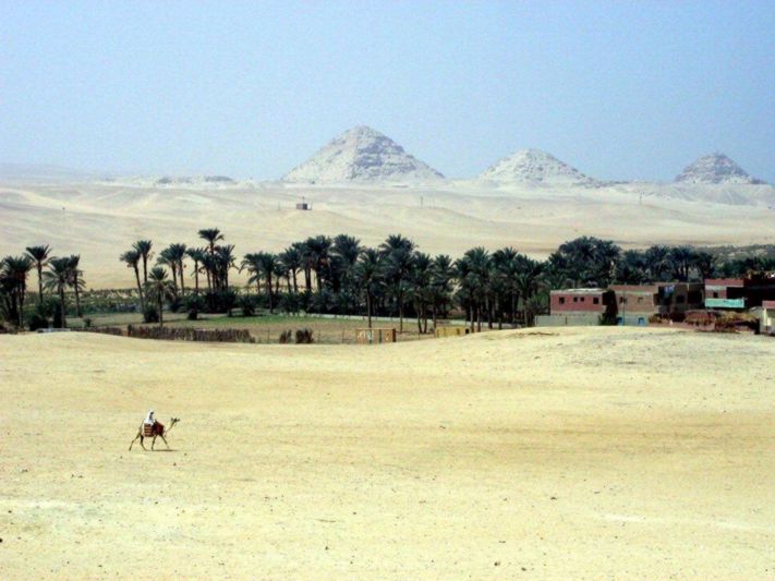
    abusir-rybnik

    The area of the defunct water reservoir near Abusír. In the background, a pyramid from the Old Kingdom period. Photo: J. Beneš

    The University of South Bohemia in České Budějovice has concluded a cooperation agreement for the years 2006-2011 with Charles University, represented by the Czech Institute of Egyptology, Faculty of Arts, Charles University in Prague. Cooperation is ensured by the Laboratory of Archaeobotany and Paleoecology, whose task was also to recommend and prepare equipment for the field paleoecology laboratory. The main topic of research cooperation is the development of the landscape in the Abusir region, based on planned analyzes of plant remains from geological sediments and from the deposits of defunct water reservoirs in the area of the pyramid fields. The area of the extinct Lake Abusir formed in ancient times the divide between the pyramid field, representing the world of the dead, and the ancient city of Memphis, the remains of which still lie largely unexplored in the Nile floodplain southeast of the pyramid fields of Abusir and Saqqara.

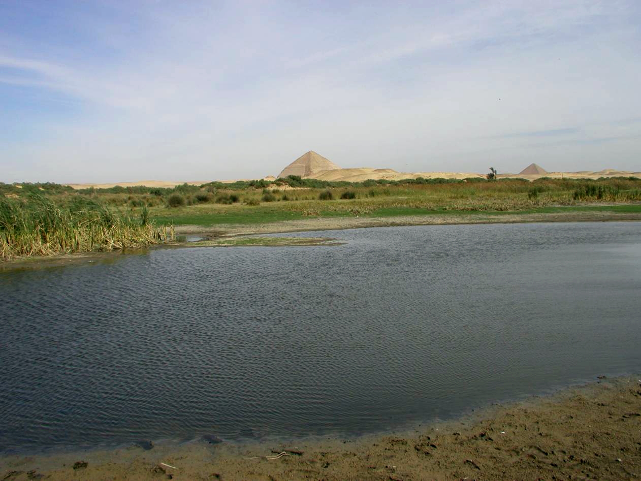
    dahsur-jezero

    Analogy: a seasonally drying lake in Dahshur, Lower Egypt. In the background Lomená and the Red Pyramid, the Old Kingdom. Photo: J. Beneš

    Why is a reservoir, whatever its origin, so important? Water and the body of water played an extraordinary role in the life of the ancient Egyptians. In the area of the royal burial ground, it separated the world of the living and the deads - the pharaohs were transported to their final resting places on ships. It is therefore very important to know the character of the extinct aquatic environment. In addition, the sediments contain important bioarcheological information that needs to be thoroughly analyzed.

    Through field sounding, which was situated in the terrain at the border of the desert and the river floodplain, a series of important findings on the development of the local terrain and samples of geological and bioarcheological material, important for the reconstruction of the local landscape in ancient times, were obtained. For example, it was found that the water body was fed not only by the seasonal floods of the Nile, but significantly also by the left bank tributaries of the river, which today form dry desert valleys. Archaeological objects, built in several cases of dry bricks, were also captured at various depths, the mass of which provided valuable natural science samples that allow special types of analysis, on the basis of which testimony can be compiled about the transformations of the local landscape in ancient times.

    • Cílek, V., et al. (2012):  Diachronic development of the Lake of Abusir during the third millennium BC, Cairo, Egypt. Quaternary International, p. 1 - 11. doi:10.1016/j.quaint.2011.12.025
    • Krejčí J., Arias Kytnarová K. et al.: Abusir XXIV. Mastaba of Werkaure, Volume I (Old Kingdome strata). Prague: Charles University in Prague, Faculty of Arts, 2014.
    • Krejčí J., Brunker Havelková P. et al.: Abusir XXVII. Mastaba of Werkaure II (Post Old Kingdome Strata). Prague: Charles University in Prague, Faculty of Arts, 2022.

Read more …Completed projects

  • Hits: 2049

A study of extinct villages in Senegal

Laboratory of Archaeobotany and Palaeoecology

A study of extinct and living villages of southeastern Senegal

Comprehensive knowledge using the methods of archaeology, anthropology and vegetation ecology

The Niokolo-Koba National Park was established in 1954 on the territory of southeastern Senegal, which was expanded in the 1960s to protect biodiversity, at the expense of local villages. The inhabitants of the original settlements therefore had to move in two waves - first beyond the borders of the newly created and then the expanded park.

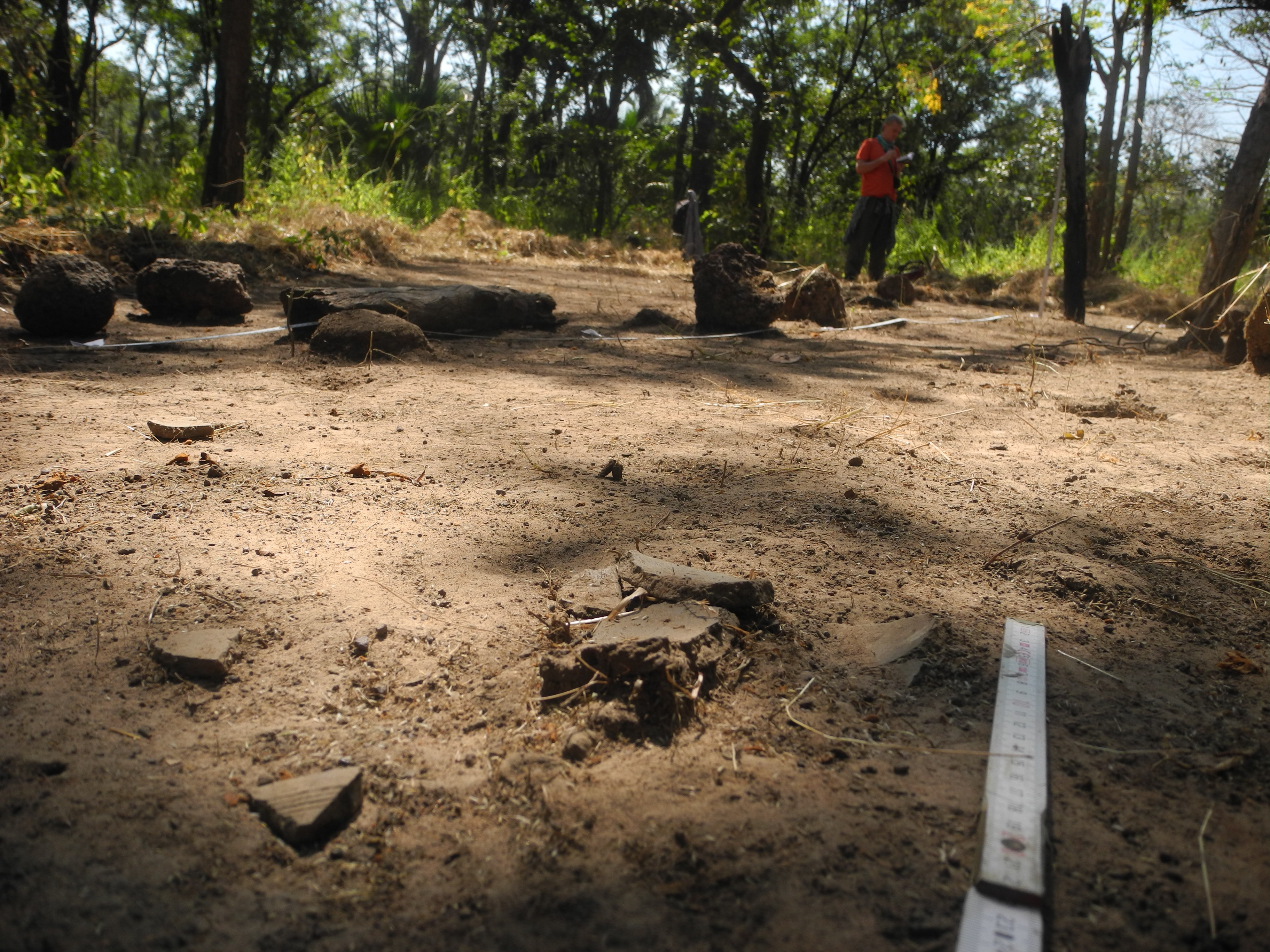
Nowadays, the remains of extinct villages can be seen in the park under the lush vegetation. The goal of the project is to document these villages and monitor their archeology over time in the environment of the local tree savannah. At the same time, the question of mutual influences arises, i.e. how quickly the local flora covered the abandoned areas and, conversely, how the activities of the then inhabitants in the monitored area are mirrored in the national park today.

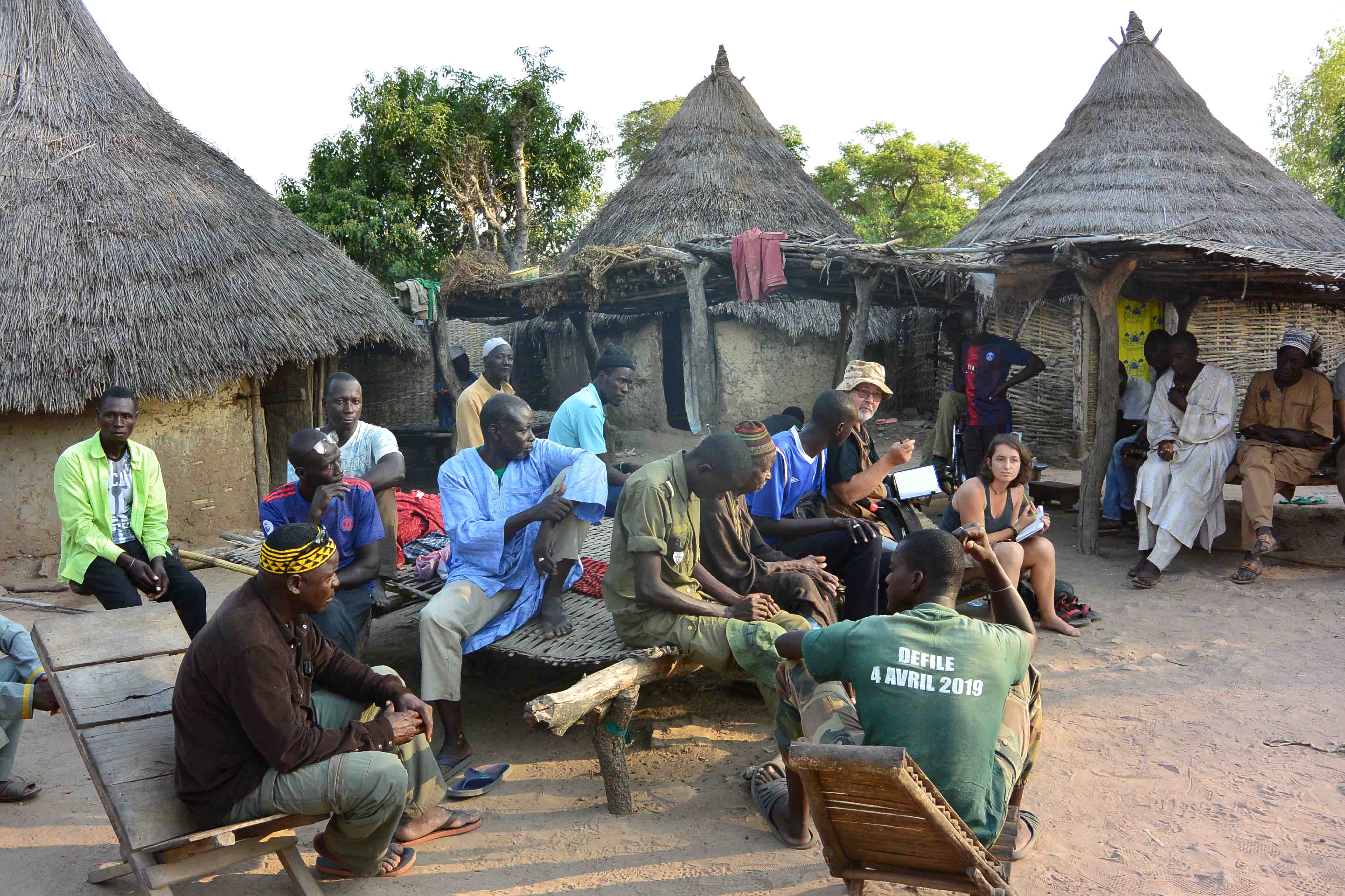
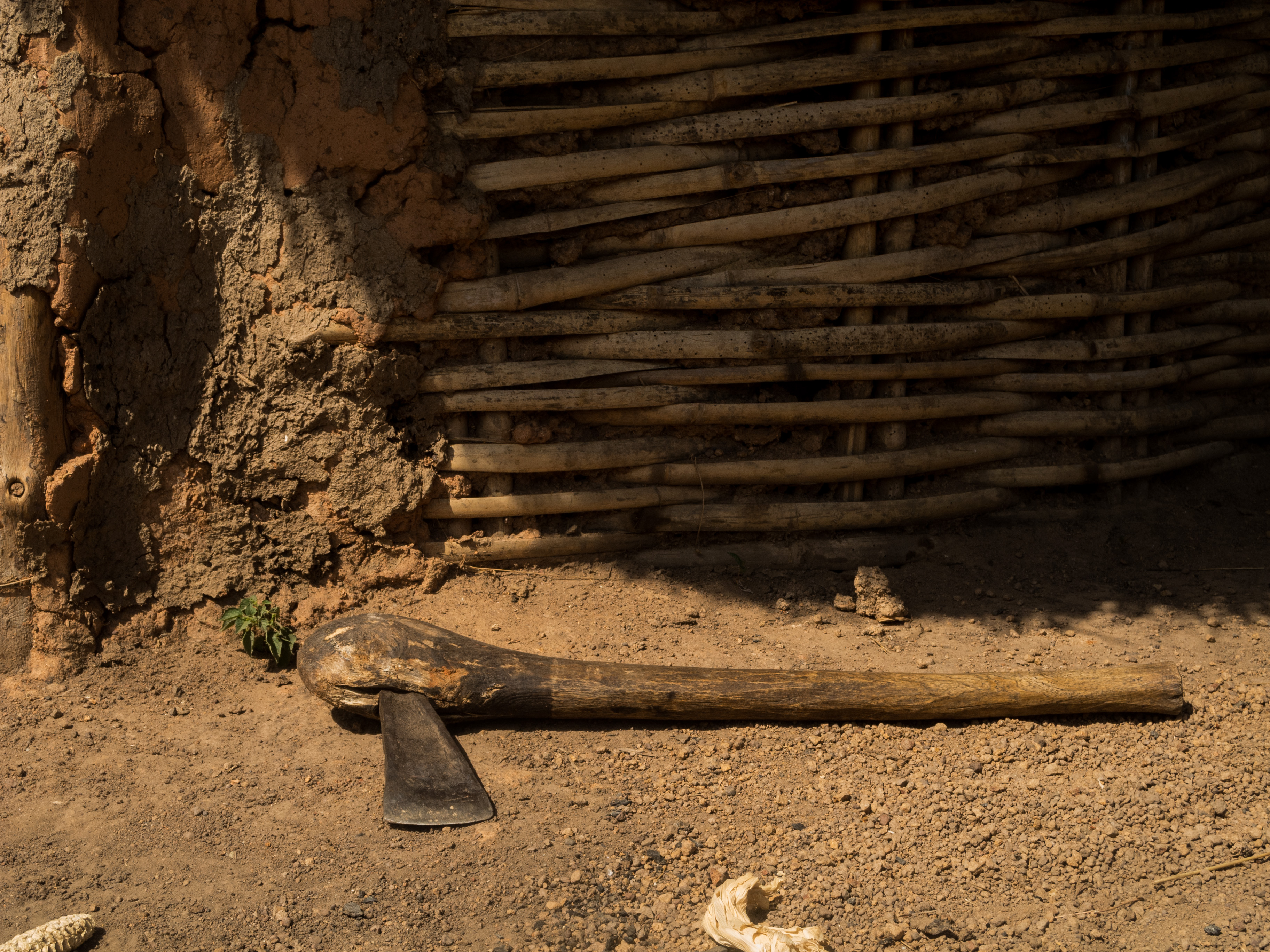
nikolo-koba_dsc_2122

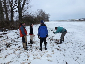
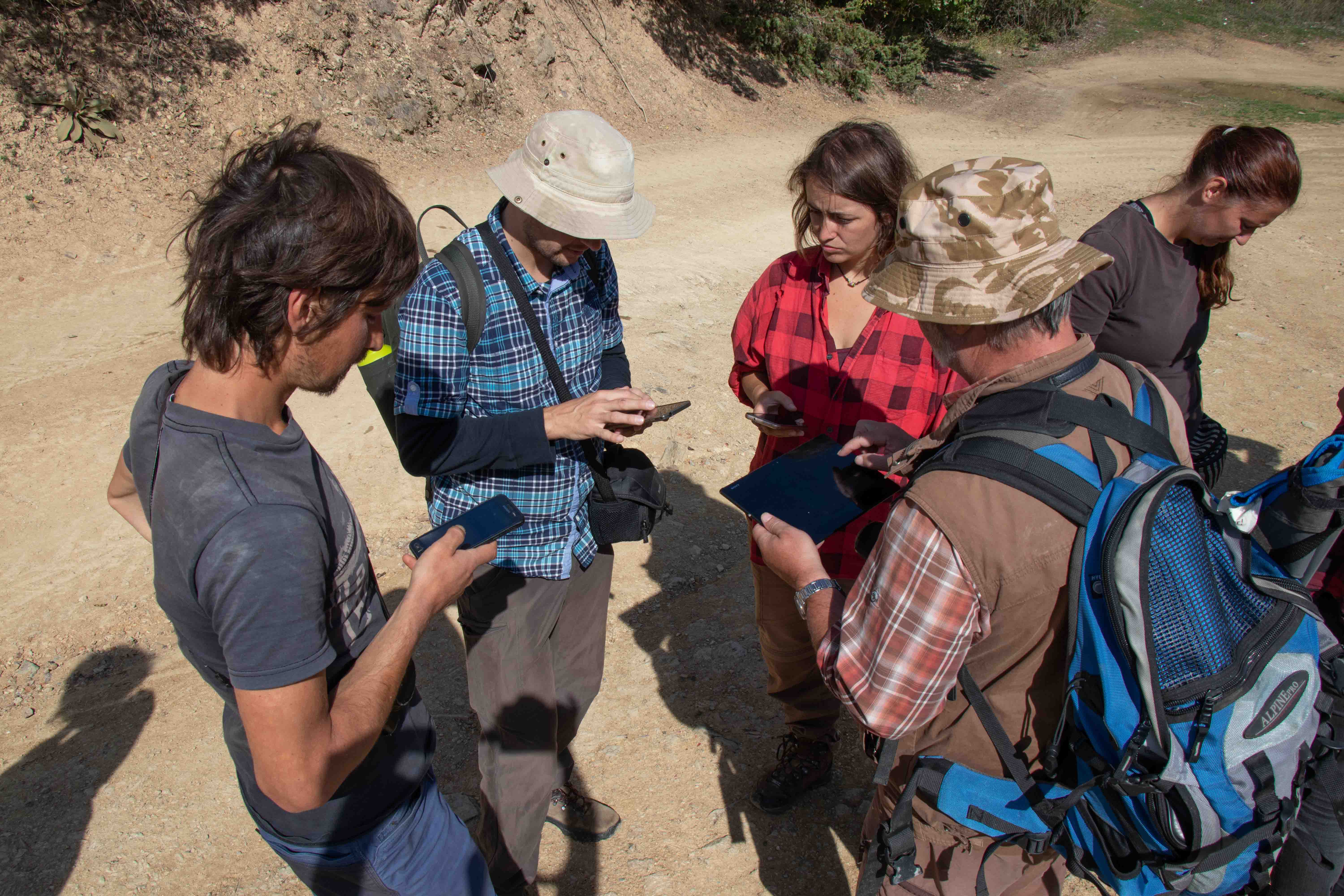
In 2018, a research team went to Senegal for the first time, consisting of: archaeologist and archaeobotanist Jaromír Beneš (LAPE, USB), archaeologist Tereza Majerovičová (LAPE, USB), botanist Jan Novák (LAPE, USB) and zoologist Lucie Stoklasová (Czech University of Life Sciences Prague). The purpose of the first expedition was to become familiar with the terrain conditions and to identify villages with potential for later research. The team also visited living villages beyond the Niokolo-Koba NP border, where the original inhabitants of the abandoned villages or their descendants were contacted. A very important step was the establishment of cooperation with the University of Dakar and the local archaeologist Alioun Deme. In the field, the team was supplemented by Idrissa Manka, a doctoral student in the field of archeology from Dakar, who, among other things, helps with translation into the various local languages.

nikolo-koba_dsc_2151

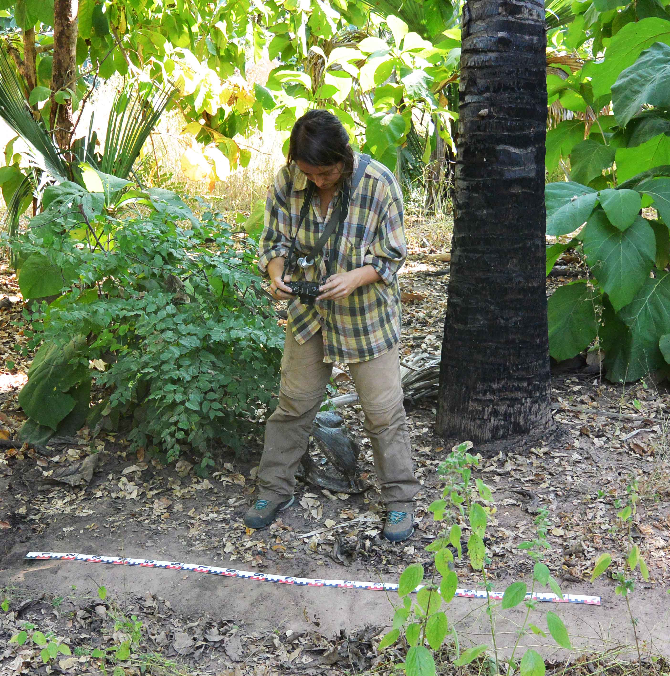
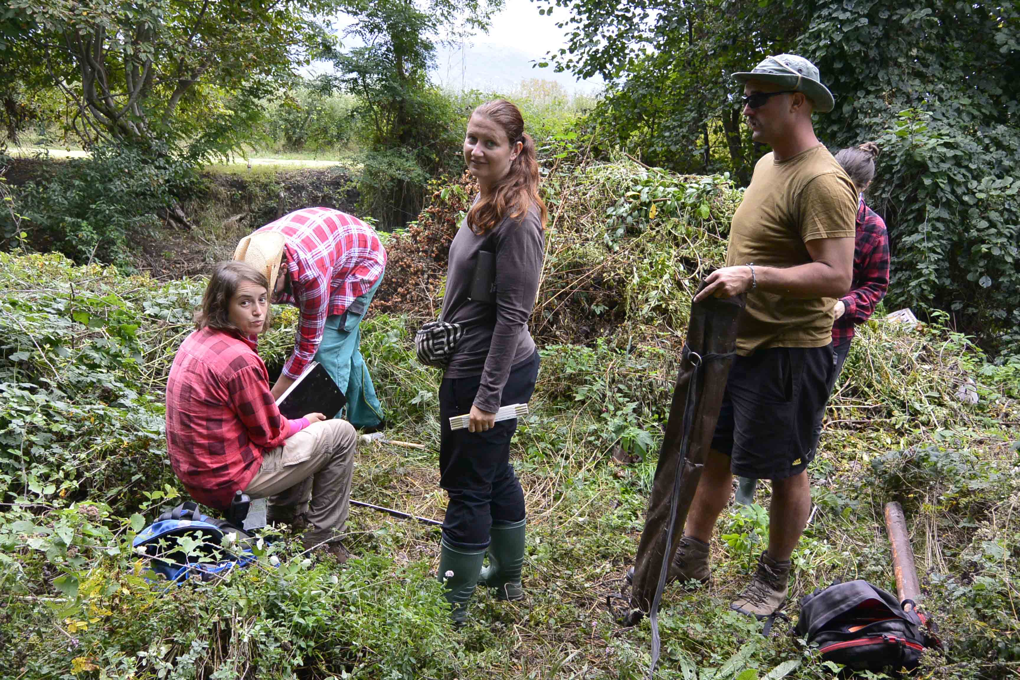
In 2019, a second expedition took place, financed mainly from the GA JU student grant of PhD student Tereza Majerovičová, who is writing a dissertation on the topic of extinct and living villages in southeastern Senegal. The team was supplemented by archaeologist and anthropologist Ladislav Šmejda, who works both at the Department of Anthropology at the University of West Bohemia  in Pilsen and at the Czech University of Life Sciences in Prague. The expedition focused on two (already selected) defunct villages: Badi and Niémeniké, and their surroundings. During field research, the team conducted transect sounding and soil sampling across villages and beyond. Furthermore, several comparative soil samples were taken from the surrounding area and the soil profile of the defunct residential units around ​​the two monitored villages was documented. The vegetation of the area was mapped, and the local trees were sampled using the dendrochronological method. These samples are now being analyzed by dendrologist Jan Altman working at the Botanical Institute of the Academy of Sciences of the Czech Republic in Třebon. Special emphasis is placed on the research of trees in ​​extinct and living villages due to their symbolism, as well as raw material usability and healing (Sacred trees: a ritual and profane relation between tree and village in Niokolo-Koba National Park, Senegal).

nikolo-koba_dscn0799 nikolo-koba_dscn1183

Back to the Research

Read more …A study of extinct villages in Senegal

  • Hits: 726

Ohrid, North Macedonia

Laboratory of Archaeobotany and Palaeoecology

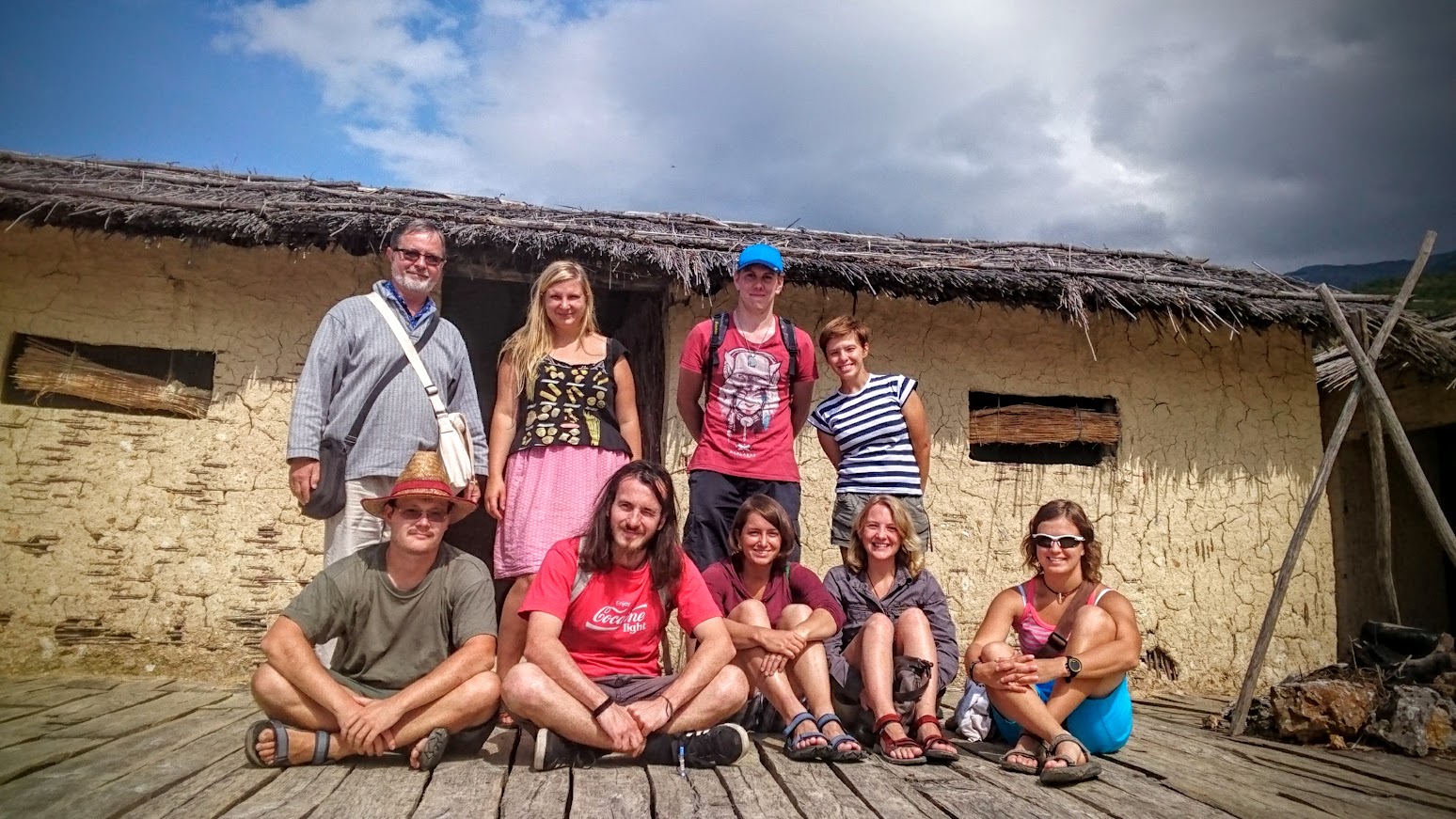
Archaeobotanical Summer School in Ohrid, North Macedonia

Archaeobotanical Summer School in Ohrid, Republic of North Macedonia as part of the international research project Frontier Studies

duration: 2019-present

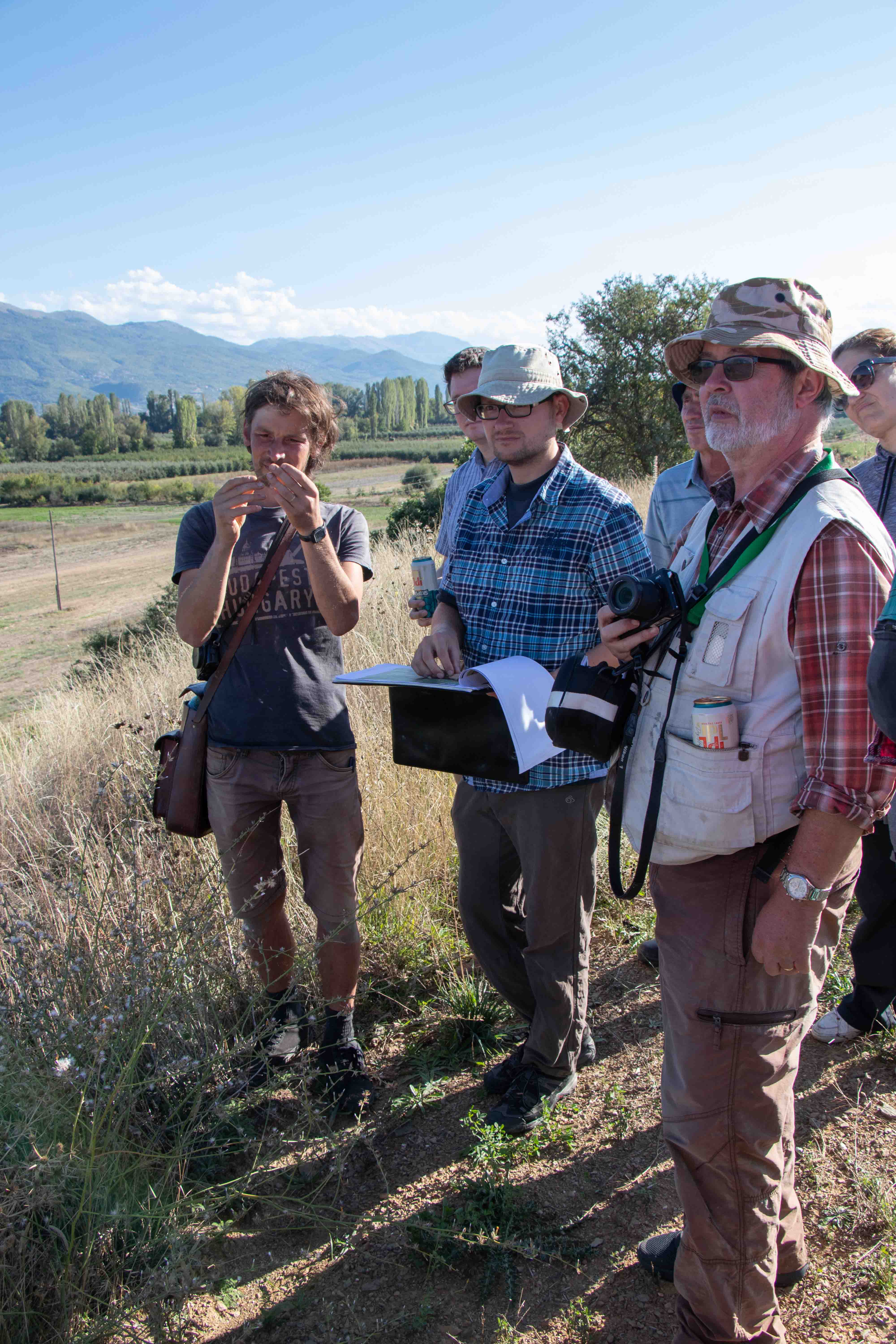
The archaeobotanical summer school has a long tradition. Its main meaning is connecting natural science with archaeology, especially with the fields of archaeobotany. Students of botany and archeology from the Faculty of Sciences and the Faculty of Arts of the University of South Bohemia are trained directly within the framework of several research projects, in this case within the framework of Frontier Studies.

ochrid_img_0292

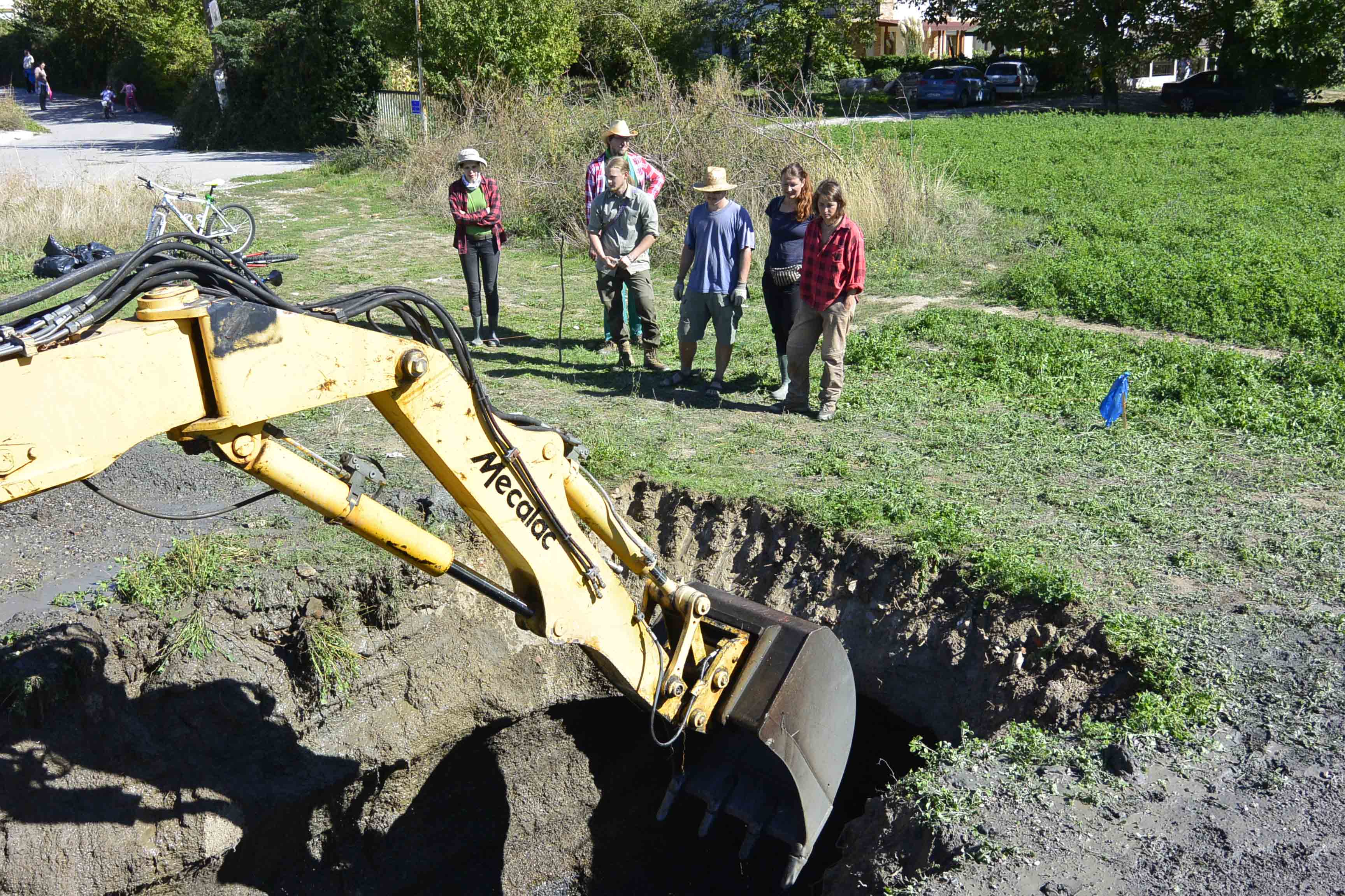
Frontier Studies is an international research project focused on the city of Ohrid and its surrounding landscape and environment. It is situated on the northern shore of the Ohrid  lake in the border region of Albania and North Macedonia. Since the start of the project in 2017, the research effort has been defined by the collaboration between Charles University in Prague (Marek Verčík, ÚKAR FF UK) and the Archaeological Museum in Skopje (Pero Ardjanljev), since 2019 also with the Czech Geological Survey (Jan Hošek) and the University of South Bohemia in České Budějovice (LAPE). The goal of the first research season, supported by the summer school of archaeobotany at the University of South Bohemia, was an extensive field survey of the historical landscape and research of the region's settlement structures dynamics, captured in the developmental sequence.

The task of the summer archaeobotanical school in this project is to obtain and provide primarily archaeobotanical data, used to explain landscape and ecological questions, focused on historical microenvironments, interesting for the description of vegetation in individual phases of the development of prehistoric and ancient settlements. The specific goal is also to create a reference database for further reconstructions.

ochrid_dsc1502

In the first year of the project, the participants of the summer school participated in the testing of several locations (Trebeniste, Grasinca I/II, Daljan, Gorno Lakocerej- Tri topoli, Bobansko ezero) by means of geological probes with an excavator or a drilling rig. These four localities were sampled. Samples were subjected to analysis of plant macroresidues, wood and carbons, AMS radiocarbon dating, pollen analysis and other methods…

The analyzes have already provided interesting results. We are not only surprised by the presence of a round settlement from Grašnice (from Late Antiquity), but above all by the evidence of an organic layer from the Younger Bronze Age based on a geological probe, whose existence under the thick lake sediment testifies to a significant tectonic event. The analyzes that are carried out confirm the dating of the ceramic fragments to the end of the Younger Bronze Age. However, they also capture the state of the landscape at the end of the prehistoric period, when the central settlement in Ohrid was surrounded by the water of the lake and coastal lagoons.

ochrid_dsc1634

ochrid_img_0170

Back to the Research

Read more …Ohrid, North Macedonia

  • Hits: 1351

Archaeozoology

Laboratory of Archaeobotany and Palaeoecology

Archaeozoology

Archaeolozoology is a scientific discipline which refers to the study of animal remains (bones, teeth, horny tissue, conches of molluscs etc.) from archaeological sites. The goal of archaeozoology is to gain and to better understand the relation between humans and animals in the past. Archaeozoology links up the archaeological informations with the results of zoological analysis. This connection can bring valuable conclusions about human nutrition because a meat formed an important component of diet next to the plants. Some animals did not serve only for the consumption purpose, they were unexpendable in the social affiliation and belief systems or they were breeded as pets for an emotional support and used for other products (fur, wool, milk, force etc.). The archaeozoological research is focused both on the macroscopic tissues of vertebrate and invertebrate and on their DNA, the traces elements or the stable isotopes contained in the bones and teeth.

archeozoologie_1

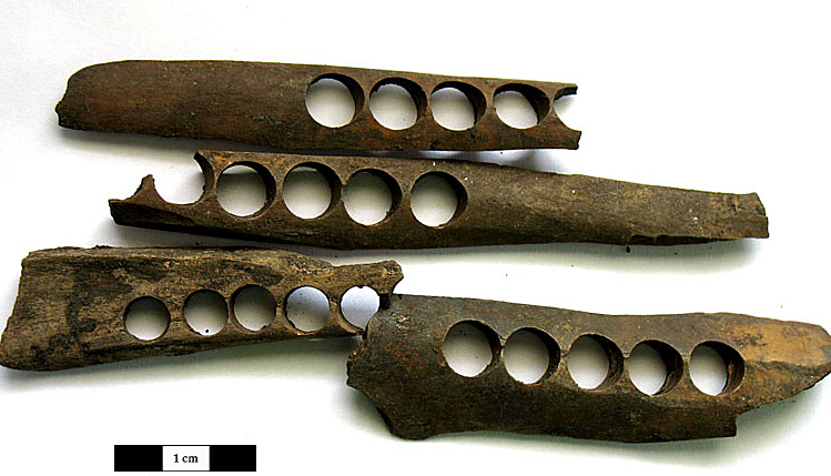
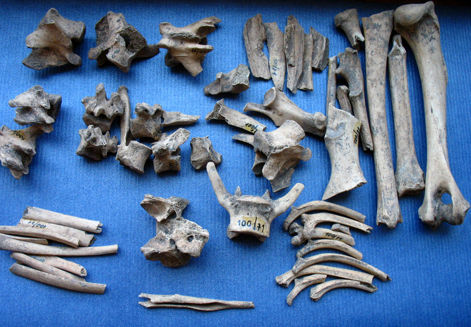
Fragments of diaphyses of long bones of large mammals, which represented a suitable raw material to produce bone buttons. Photo: L. Kovačíková

The archaeozoological research is primarily based on identification, analysis and interpretation. The identification stage can be equated with collecting primary data (taxonomic identification, elements represented, specimen count, modifications and pathologies, anatomical features of age and sex, measurements, taphonomy etc.). The analytical part is deriving from secondary data (body dimensions, slaughtering profiles, sex ratios, relative frequencies of taxa or skeletal frequency etc.). Primary and secondary data form the basis for interpretations, which focus on the human subsistence strategies, domestication of animals, spacial and temporal aspects of the animal resources etc.

archeozoologie_2

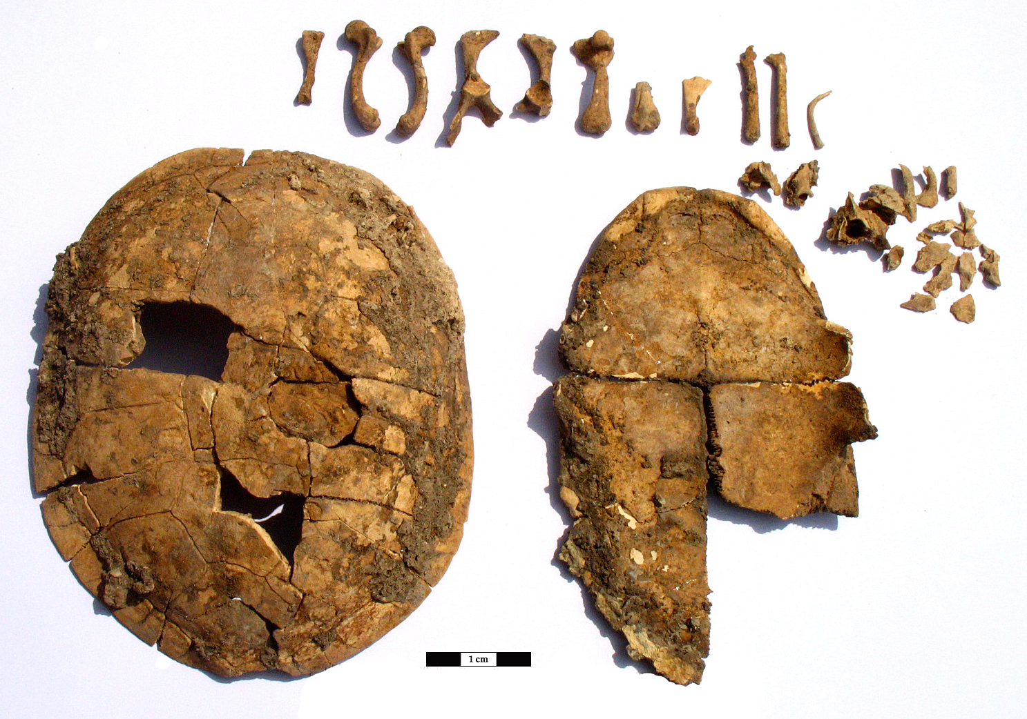
Remains of an European pond turtle (Emys orbicularis) from an early medieval site in Mělník, Nůšařská Street. Photo: L. Kovačíková

Study of archaeozoology at the University of South Bohemia:

  • Archaeozoology (KZO/163) – Faculty of Science (Department of zoology, master´s degree)
  • Archaeozoology for archaeologists (UAR AZA) – Faculty of Philosophy (Institute of archeology, master´s degree)
  • Introduction to environmental archaeology II (UAR/RUE2) – Faculty of Philosophy (Institute of archeology, bachelor degree)

archeozoologie_3

The metatarsal bone of an adult horse (Equus caballus), which is shaped like a skate. Found in Prague, V Tůních 6. Photo: L. Kovačiková

archeozoologie_4

An incomplete skeleton of an adult dog (Canis familiaris) discovered during archaeological research in Staré Badry. Photo: L. Kovačíková

Back to the Research

Read more …Archaeozoology

  • Hits: 1518

Stay in touch
social media

© 2024 University of South Bohemia
Cookies

1

0